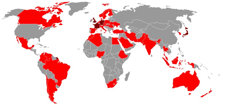
File:Middle Powers.PNG
Appearance

Size of this preview: 800 × 370 pixels. Other resolutions: 320 × 148 pixels | 640 × 296 pixels | 1,350 × 625 pixels.
Original file (1,350 × 625 pixels, file size: 36 KB, MIME type: image/png)
File history
Click on a date/time to view the file as it appeared at that time.
| Date/Time | Thumbnail | Dimensions | User | Comment | |
|---|---|---|---|---|---|
| current | 21:33, 2 April 2018 |  | 1,350 × 625 (36 KB) | Maphobbyist | South Sudan border |
| 23:41, 17 April 2012 |  | 1,350 × 625 (46 KB) | Phoenix B 1of3 | Greenland is part of Denmark, Guiana is part of France | |
| 23:39, 17 April 2012 |  | 1,350 × 625 (46 KB) | Phoenix B 1of3 | Corsica is part of france | |
| 18:35, 24 May 2009 |  | 1,350 × 625 (46 KB) | ChrisDHDR | changed colours of UK, France, Japan, & Germany as per request at WP:GL/MAP | |
| 00:55, 19 October 2008 |  | 1,350 × 625 (47 KB) | Tavrian | + Ukraine per refs at http://en.wikipedia.org/wiki/Middle_power | |
| 20:28, 16 July 2008 |  | 1,350 × 625 (29 KB) | UKPhoenix79 | revised based on updated list | |
| 20:27, 26 March 2008 |  | 1,350 × 625 (47 KB) | Dwrcan | ||
| 20:23, 26 March 2008 |  | 1,350 × 625 (47 KB) | Dwrcan | {{Information |Description=World map showing middle powers of the world |Source=self-made, based on Middle power article. |Date=March 2008 |Author= Sbw01f |Permission= |other_versions=[http://en.wikipedia.org/wiki/Image:Middle_powers-1 |
File usage
The following page uses this file:

