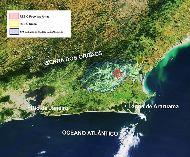
File:Micoleaodourado rebios.jpg
Appearance

Size of this preview: 726 × 599 pixels. Other resolutions: 291 × 240 pixels | 582 × 480 pixels | 931 × 768 pixels | 1,054 × 870 pixels.
Original file (1,054 × 870 pixels, file size: 732 KB, MIME type: image/jpeg)
File history
Click on a date/time to view the file as it appeared at that time.
| Date/Time | Thumbnail | Dimensions | User | Comment | |
|---|---|---|---|---|---|
| current | 00:27, 5 March 2013 |  | 1,054 × 870 (732 KB) | Miguelrangeljr | Changes in limits. |
| 00:18, 5 March 2013 |  | 1,054 × 870 (735 KB) | Miguelrangeljr | Added São João Basin Environment Protection Area limits (blue line). Added caption. | |
| 12:24, 2 March 2013 |  | 2,250 × 1,858 (383 KB) | Miguelrangeljr | {{Information |Description ={{en|1=Satellite image showing the localization and area of Poço das Antas Biological Reserve and União Reserve, at Rio de Janeiro State, Brazil. The red line encloses Poço das Antas limits, and the yellow line enclose... |
File usage
The following page uses this file:
Global file usage
The following other wikis use this file:
- Usage on pt.wikipedia.org
- Usage on www.wikidata.org


