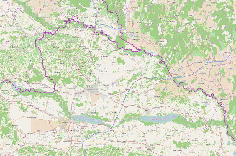
File:Međimurje County OpenStreetMap.svg
Appearance

Size of this PNG preview of this SVG file: 800 × 529 pixels. Other resolutions: 320 × 212 pixels | 640 × 423 pixels | 1,024 × 677 pixels | 1,280 × 846 pixels | 2,560 × 1,693 pixels | 3,029 × 2,003 pixels.
Original file (SVG file, nominally 3,029 × 2,003 pixels, file size: 21.69 MB)
File history
Click on a date/time to view the file as it appeared at that time.
| Date/Time | Thumbnail | Dimensions | User | Comment | |
|---|---|---|---|---|---|
| current | 08:18, 5 February 2015 |  | 3,029 × 2,003 (21.69 MB) | Vedran V | A new version of file |
| 22:11, 6 March 2010 |  | 701 × 454 (1.25 MB) | Ex13 | new | |
| 22:06, 6 March 2010 |  | 1,580 × 1,023 (1.44 MB) | Ex13 | new | |
| 22:02, 6 March 2010 |  | 359 × 228 (929 KB) | Ex13 | {{OpenStreetMap|location=Međimurska županija}} Category:Međimurje County Category:Maps of counties of Croatia |
File usage
The following 2 pages use this file:
Global file usage
The following other wikis use this file:
- Usage on bs.wikipedia.org
- Usage on de.wikipedia.org
- Usage on fa.wikipedia.org
- Usage on hr.wikipedia.org
- Usage on mk.wikipedia.org
- Usage on sco.wikipedia.org
- Usage on sh.wikipedia.org
- Usage on sr.wikipedia.org
- Белица (општина)
- Прибиславец
- Света Марија (општина)
- Свети Јурај на Брегу
- Декановец
- Домашинец
- Горичан
- Вратишинец
- Доња Дубрава (Међимурје)
- Горњи Михаљевец
- Доњи Видовец
- Доњи Краљевец (општина)
- Коториба
- Мала Суботица
- Неделишће
- Ореховица (општина)
- Подтурен
- Шаблон:Location map Međimurska županija
- Селница (општина)
- Страхонинец
- Свети Мартин на Мури
- Шенковец (општина)
- Штригова
- Гардиновец
- Ходошан
- Ивановец
- Куршанец
- Мачковец (Чаковец)
- Миховљан (Чаковец)
- Новаковец (Подтурен)
- Ново Село Рок
- Паловец
- Пекленица
- Пушћине
- Савска Вес
- Цирковљан
- Горњи Храшћан
- Сивица
- Трновец (Неделишће)
- Дуњковец
View more global usage of this file.
