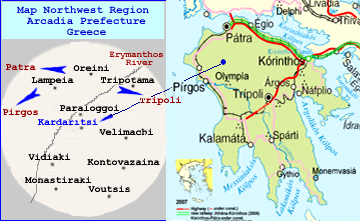
File:MapofGR-kardaritsiArcadias.png
Appearance
MapofGR-kardaritsiArcadias.png (360 × 221 pixels, file size: 110 KB, MIME type: image/png)
File history
Click on a date/time to view the file as it appeared at that time.
| Date/Time | Thumbnail | Dimensions | User | Comment | |
|---|---|---|---|---|---|
| current | 02:20, 6 September 2009 |  | 360 × 221 (110 KB) | Tjellis1940 | {{Information |Description={{de|Wichtigste Verkehrsachsen des Peloponnes, Stand 2007.}} {{en|Main traffic lines in the Peloponnese, as of 2007.}} |Source=*File:Peloponnesos_Map.png |Date=2009-09-06 02:14 (UTC) |
| 23:29, 5 September 2009 |  | 360 × 221 (110 KB) | Tjellis1940 | {{Information |Description=Image |Source=self-made |Date=9-5-2009 |Author= Tjellis1940 |Permission=Public Domain |other_versions= }} Category:Kardaritsi Arkadias |
File usage
The following 2 pages use this file:

