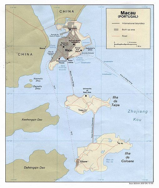
File:MapaMacau1986.jpg
Appearance

Size of this preview: 509 × 599 pixels. Other resolutions: 204 × 240 pixels | 408 × 480 pixels | 652 × 768 pixels | 1,048 × 1,234 pixels.
Original file (1,048 × 1,234 pixels, file size: 160 KB, MIME type: image/jpeg)
File history
Click on a date/time to view the file as it appeared at that time.
| Date/Time | Thumbnail | Dimensions | User | Comment | |
|---|---|---|---|---|---|
| current | 11:17, 2 March 2007 |  | 1,048 × 1,234 (160 KB) | AdriAg | This map represents [http://en.wikipedia.org/wiki/Macau Macau] in 1986, when this small territory was administrated by Portugal. In that time, Macau didn't have an airport yet. |
File usage
The following page uses this file:
Global file usage
The following other wikis use this file:
- Usage on de.wikipedia.org
- Usage on fr.wikipedia.org
- Usage on pt.wikipedia.org
- Usage on www.wikidata.org
- Usage on zh.wikipedia.org

