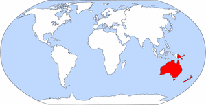
File:Map of world highlighting Oceania.png
Appearance
Map_of_world_highlighting_Oceania.png (300 × 153 pixels, file size: 12 KB, MIME type: image/png)
File history
Click on a date/time to view the file as it appeared at that time.
| Date/Time | Thumbnail | Dimensions | User | Comment | |
|---|---|---|---|---|---|
| current | 13:05, 31 January 2006 |  | 300 × 153 (12 KB) | ChongDae | This image was copied from wikipedia:en. The original description was: Originally from the [http://www.cia.gov/cia/publications/factbook/ CIA Factbook], modified to highlight various regions. Category:Continent locator maps {{PD-USGov-CIA-WF}} {| bo |
File usage
No pages on the English Wikipedia use this file (pages on other projects are not listed).
Global file usage
The following other wikis use this file:
- Usage on ca.wikipedia.org
- Austràlia
- Oceania
- Niue
- Estats Federats de Micronèsia
- Illes Marshall
- Illes Mariannes Septentrionals
- Fiji
- Nova Zelanda
- Salomó (estat)
- Papua Nova Guinea
- Samoa
- Hawaii
- Vanuatu
- Tuvalu
- Tonga
- Kiribati
- República de Palau
- Nauru
- Polinèsia Francesa
- Illes Cook
- Illa de Pasqua
- Samoa Nord-americana
- Tokelau
- Illes Pitcairn
- Wallis i Futuna
- Plantilla:Oceania
- Illes d'Ultramar Menors dels Estats Units
- Illes Wake
- Guam
- Illa Norfolk
- Nova Caledònia
- Papua Occidental
- Usage on ie.wikipedia.org
- Usage on roa-tara.wikipedia.org
- Usage on se.wikipedia.org
- Usage on zh-min-nan.wikipedia.org


