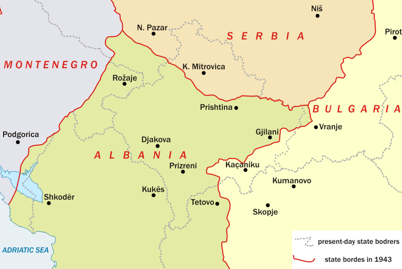
File:Map of Kosovo during WW II.png
Appearance
Map_of_Kosovo_during_WW_II.png (783 × 524 pixels, file size: 97 KB, MIME type: image/png)
File history
Click on a date/time to view the file as it appeared at that time.
| Date/Time | Thumbnail | Dimensions | User | Comment | |
|---|---|---|---|---|---|
| current | 08:11, 27 January 2010 |  | 783 × 524 (97 KB) | Пакко | {{Information |Description={{en|1=Map of Kosovo during World War II}} Карта на Косово по време на Втората световна война |Source=[http://anamnesis.info/resources/Albania_during_WW2.gif www.anamnesis.info - Albania |
File usage
The following 9 pages use this file:
- 20th-century history of Kosovo
- Axis occupation of Serbia
- Demographic history of Kosovo
- History of Kosovo
- Insurgency in Karadak–Gollak (1941–1951)
- Yugoslav colonization of Kosovo
- User:Falcaorib/Serbia, Yugoslavia and Albania
- User:GermanManFromFrankfurt/sandbox
- File talk:Map of Kosovo during WW II.png
Global file usage
The following other wikis use this file:
- Usage on bg.wikipedia.org
- Usage on bn.wikipedia.org
- Usage on hu.wikipedia.org
- Usage on hy.wikipedia.org
- Usage on it.wikipedia.org
- Usage on mk.wikipedia.org
- Usage on pt.wikipedia.org
- Usage on ro.wikipedia.org
- Usage on ru.wikipedia.org
- Usage on sh.wikipedia.org
- Usage on sq.wikipedia.org
- Usage on sr.wikipedia.org
- Usage on uk.wikipedia.org


