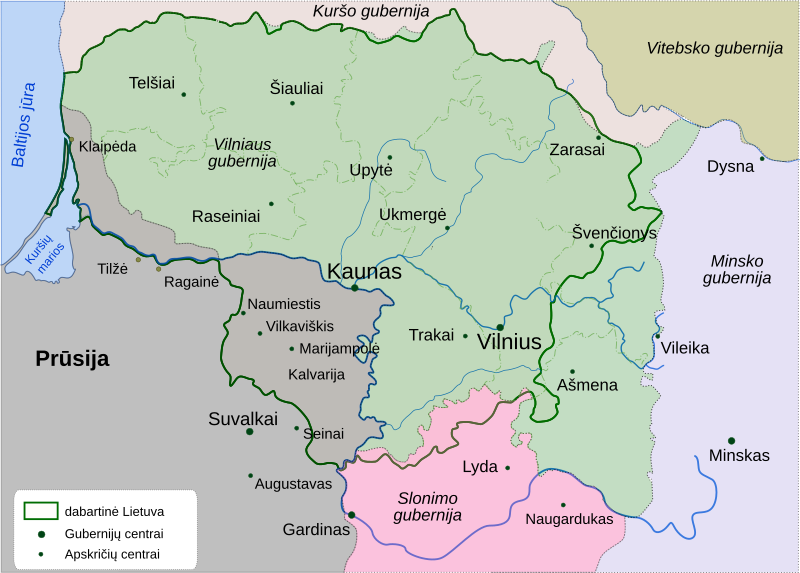
File:Lithuania-1795.svg
Appearance

Size of this PNG preview of this SVG file: 800 × 573 pixels. Other resolutions: 320 × 229 pixels | 640 × 458 pixels | 1,024 × 733 pixels | 1,280 × 917 pixels | 2,560 × 1,833 pixels | 863 × 618 pixels.
Original file (SVG file, nominally 863 × 618 pixels, file size: 306 KB)
File history
Click on a date/time to view the file as it appeared at that time.
| Date/Time | Thumbnail | Dimensions | User | Comment | |
|---|---|---|---|---|---|
| current | 14:02, 11 November 2024 |  | 863 × 618 (306 KB) | Andrei Stroe | File uploaded using svgtranslate tool (https://svgtranslate.toolforge.org/). Added translation for ro. |
| 08:01, 3 October 2017 |  | 863 × 618 (293 KB) | Sbaio | Correction of name for Prussia. | |
| 14:39, 31 December 2005 |  | 881 × 638 (648 KB) | Knutux | correction: Panevėžys district in 1795 was Upytė district | |
| 14:21, 31 December 2005 |  | 881 × 638 (648 KB) | Knutux | Lithuania after last partition (at 1795) Category:Historical maps of Lithuania |
File usage
The following 2 pages use this file:
Global file usage
The following other wikis use this file:
- Usage on be-tarask.wikipedia.org
- Usage on et.wikipedia.org
- Usage on fi.wikipedia.org
- Usage on it.wikipedia.org
- Usage on lt.wikipedia.org
- Usage on lt.wikibooks.org
- Usage on lv.wikipedia.org
- Usage on no.wikipedia.org
- Usage on pl.wikipedia.org
- Usage on ro.wikipedia.org
- Usage on ru.wikipedia.org
