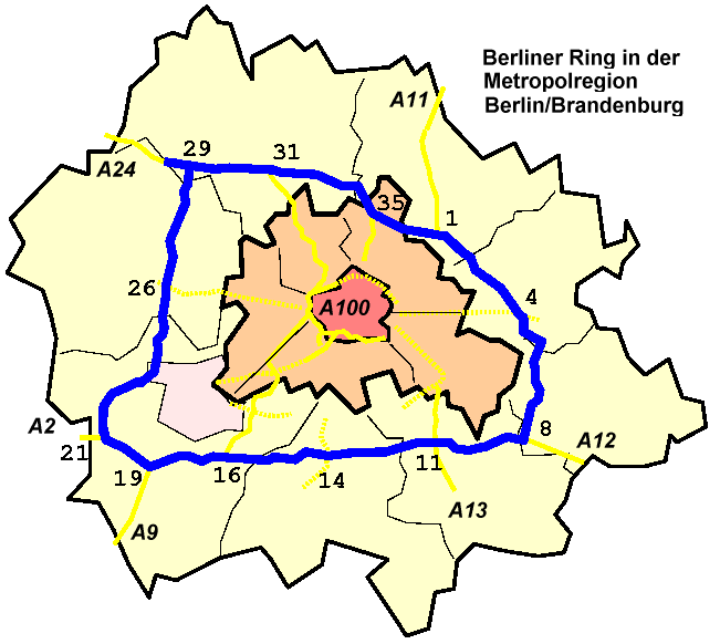
File:Lage Berliner Ring Metropolregion Berlin.png
Appearance
Lage_Berliner_Ring_Metropolregion_Berlin.png (651 × 582 pixels, file size: 26 KB, MIME type: image/png)
File history
Click on a date/time to view the file as it appeared at that time.
| Date/Time | Thumbnail | Dimensions | User | Comment | |
|---|---|---|---|---|---|
| current | 23:40, 25 January 2007 |  | 651 × 582 (26 KB) | Nicke L | {{Information |Description=Lage_Berliner_Ring_Metropolregion_Berlin * '''Anschlussstellen''': siehe de:Berliner Ring/A10 * '''Regionalkarte''': siehe de:Metropolregion Berlin/Brandenburg |Source= *selbstgezeichnet, vergleiche [[:de:Metropolregio |
File usage
The following page uses this file:
Global file usage
The following other wikis use this file:
- Usage on af.wikipedia.org
- Usage on ar.wikipedia.org
- Usage on da.wikipedia.org
- Usage on de.wikipedia.org
- Usage on es.wikipedia.org
- Usage on fa.wikipedia.org
- Usage on fr.wikipedia.org
- Usage on he.wikipedia.org
- Usage on nds.wikipedia.org
- Usage on pt.wikipedia.org
- Usage on sq.wikipedia.org
- Usage on sv.wikipedia.org
- Usage on www.wikidata.org
- Usage on zh.wikipedia.org

