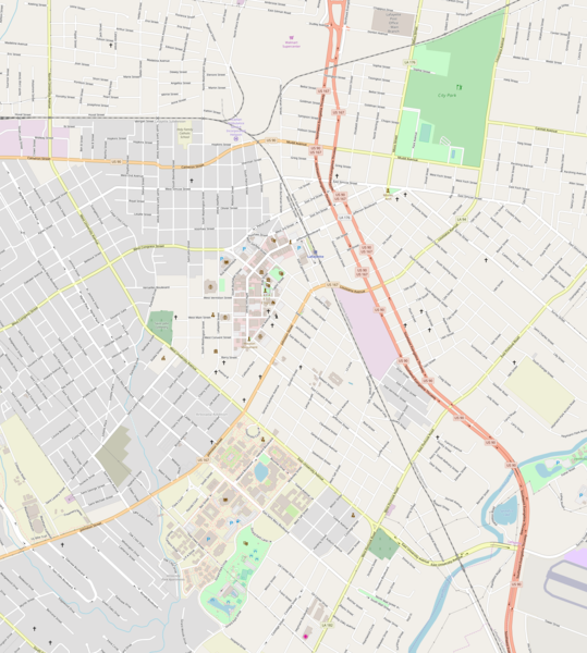
File:Lafayette, Louisiana.png
Appearance

Size of this preview: 539 × 600 pixels. Other resolutions: 216 × 240 pixels | 431 × 480 pixels | 690 × 768 pixels | 920 × 1,024 pixels | 1,890 × 2,103 pixels.
Original file (1,890 × 2,103 pixels, file size: 1.78 MB, MIME type: image/png)
File history
Click on a date/time to view the file as it appeared at that time.
| Date/Time | Thumbnail | Dimensions | User | Comment | |
|---|---|---|---|---|---|
| current | 13:16, 4 July 2018 |  | 1,890 × 2,103 (1.78 MB) | ProprioMe OW | {{Information |description ={{en|1=Map of Lafayette, Louisiana}} |date =2018-07-04 |source =OpenStreetMap |author =OpenStreetMap }} |
File usage
The following 19 pages use this file:
- Alexandre Mouton House
- Brandt House (Lafayette, Louisiana)
- Charles H. Mouton House
- Daigle House
- Elrose (Lafayette, Louisiana)
- Evangeline Hotel
- First United Methodist Church (Lafayette, Louisiana)
- Gordon Hotel
- Holy Rosary Institute
- Hope Lodge No. 145
- J. Arthur Roy House
- Lafayette Elementary School (Lafayette, Louisiana)
- Lafayette Hardware Store
- Old Guaranty Bank Building
- Old Lafayette City Hall
- St. John's Cathedral (Lafayette, Louisiana)
- Module:Location map/data/Lafayette
- Module:Location map/data/USA Louisiana Lafayette
- Module:Location map/data/USA Louisiana Lafayette/doc
Global file usage
The following other wikis use this file:
- Usage on fr.wikipedia.org
- Usage on si.wikipedia.org

