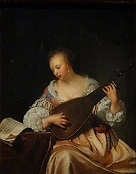
File:La Joueuse de théorbe - Frans van Mieris - Q28925862.jpg
Appearance

Size of this preview: 467 × 600 pixels. Other resolutions: 187 × 240 pixels | 374 × 480 pixels | 598 × 768 pixels | 797 × 1,024 pixels | 2,000 × 2,569 pixels.
Original file (2,000 × 2,569 pixels, file size: 1.1 MB, MIME type: image/jpeg)
File history
Click on a date/time to view the file as it appeared at that time.
| Date/Time | Thumbnail | Dimensions | User | Comment | |
|---|---|---|---|---|---|
| current | 13:23, 11 March 2017 |  | 2,000 × 2,569 (1.1 MB) | Shonagon | User created page with UploadWizard |
File usage
The following 3 pages use this file:
Global file usage
The following other wikis use this file:
- Usage on ja.wikipedia.org
- Usage on www.wikidata.org
- User:Multichill/Museum collection differences
- Q27976019
- Wikidata:WikiProject sum of all paintings/Collection/National Galleries of Scotland
- Wikidata:WikiProject sum of all paintings/Creator/Frans van Mieris the Elder
- Wikidata:WikiProject sum of all paintings/Collection/Bavarian State Painting Collections/17th Century
- Wikidata:WikiProject sum of all paintings/Catalog/Vermeer and the Masters of Genre Painting
- Wikidata:WikiProject sum of all paintings/Catalog/Frans van Mieris catalog raisonné, 1928
- Wikidata:WikiProject sum of all paintings/Catalog/Frans van Mieris (1635-1681), the Elder

