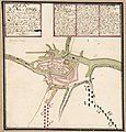
File:Kungsboken-karta-pultusk.jpg
Appearance

Size of this preview: 573 × 600 pixels. Other resolutions: 229 × 240 pixels | 459 × 480 pixels | 734 × 768 pixels | 978 × 1,024 pixels | 1,957 × 2,048 pixels | 5,220 × 5,464 pixels.
Original file (5,220 × 5,464 pixels, file size: 3.43 MB, MIME type: image/jpeg)
File history
Click on a date/time to view the file as it appeared at that time.
| Date/Time | Thumbnail | Dimensions | User | Comment | |
|---|---|---|---|---|---|
| current | 10:16, 28 November 2022 |  | 5,220 × 5,464 (3.43 MB) | Nils Weinander (Riksarkivet Sverige) | Remaining Kungsboken itemsꓹ commons images by OpenRefine (details) |
File usage
The following page uses this file:
Global file usage
The following other wikis use this file:
- Usage on lt.wikipedia.org
- Usage on sv.wikipedia.org
- Usage on www.wikidata.org


