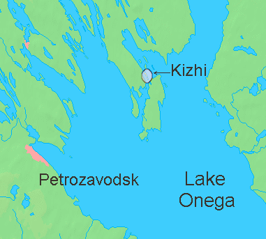
File:Kizhimap2.png
Appearance
Kizhimap2.png (381 × 343 pixels, file size: 30 KB, MIME type: image/png)
File history
Click on a date/time to view the file as it appeared at that time.
| Date/Time | Thumbnail | Dimensions | User | Comment | |
|---|---|---|---|---|---|
| current | 07:37, 13 June 2010 |  | 381 × 343 (30 KB) | Materialscientist | add details |
| 07:12, 13 June 2010 |  | 381 × 343 (30 KB) | Materialscientist | {{Information |Description={{en|Lake Onega in Russia with Kizhi island marked }} |Source=*File:La2-demis-onega.png |Date=2010-06-13 07:12 (UTC) |Author=*File:La2-demis-onega.png: Demis map server *derivative work: ~~~ |Permission=see below |ot |
File usage
The following page uses this file:
Global file usage
The following other wikis use this file:
- Usage on ar.wikipedia.org
- Usage on ba.wikipedia.org
- Usage on eo.wikipedia.org
- Usage on es.wikipedia.org
- Usage on fr.wikipedia.org
- Usage on hr.wikipedia.org
- Usage on it.wikivoyage.org
- Usage on ja.wikipedia.org
- Usage on sh.wikipedia.org
- Usage on tr.wikipedia.org
- Usage on tt.wikipedia.org
- Usage on uk.wikipedia.org
- Usage on www.wikidata.org

