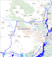
File:Karte der Wasserstraßen in Potsdam.png
Appearance

Size of this preview: 646 × 599 pixels. Other resolutions: 259 × 240 pixels | 518 × 480 pixels | 828 × 768 pixels | 1,104 × 1,024 pixels | 1,311 × 1,216 pixels.
Original file (1,311 × 1,216 pixels, file size: 530 KB, MIME type: image/png)
File history
Click on a date/time to view the file as it appeared at that time.
| Date/Time | Thumbnail | Dimensions | User | Comment | |
|---|---|---|---|---|---|
| current | 06:46, 13 June 2020 |  | 1,311 × 1,216 (530 KB) | Chumwa | corr |
| 12:06, 30 May 2009 |  | 1,311 × 1,216 (533 KB) | Chumwa | {{Information |Description= *{{ de }} Karte der Wasserstraßen in Potsdam |Source=Self made, using * PDF-Exports der Region Berlin aus [http://www.openstreetmap.org OpenStreetMap] * [http://www.wsa-b.de/wasserstrassen/images1/karte_mit_bildern..pdf Karte] |
File usage
The following page uses this file:
Global file usage
The following other wikis use this file:
- Usage on arz.wikipedia.org
- Usage on de.wikipedia.org
- Havel
- Sacrow-Paretzer Kanal
- Weißer See (Potsdam)
- Weisse Flotte Potsdam
- Benutzer Diskussion:Chumwa/Archiv/2008/3. Quartal
- Nedlitz (Potsdam)
- Diskussion:Sacrow-Paretzer Kanal
- Wikipedia:Administratoren/Anfragen/Archiv/2016/März
- Benutzer:Z thomas/BB-0
- Benutzer:Global Fish/Baustelle/Baustelle I
- Benutzer:Xiongda/Havel
- Usage on fr.wikipedia.org
- Usage on www.wikidata.org


