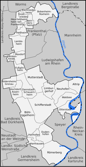
File:Karte Rhein-Pfalz-Kreis.svg
Appearance

Size of this PNG preview of this SVG file: 296 × 574 pixels. Other resolutions: 124 × 240 pixels | 247 × 480 pixels | 396 × 768 pixels | 528 × 1,024 pixels | 1,056 × 2,048 pixels.
Original file (SVG file, nominally 296 × 574 pixels, file size: 512 KB)
File history
Click on a date/time to view the file as it appeared at that time.
| Date/Time | Thumbnail | Dimensions | User | Comment | |
|---|---|---|---|---|---|
| current | 10:44, 8 February 2008 |  | 296 × 574 (512 KB) | Niabot | corrected version |
| 18:47, 1 February 2008 |  | 296 × 574 (111 KB) | Lencer | {{Information |Description= Karte der Gemeinden des Rhein-Pfalz-Kreises, sowie der umliegenden Landkreise und Kreisfreien Städte |Source="own work" |Date=Februar 2008 |Author=Lencer |other_versions=[[:Image:Karte |
File usage
No pages on the English Wikipedia use this file (pages on other projects are not listed).
Global file usage
The following other wikis use this file:
- Usage on de.wikipedia.org


