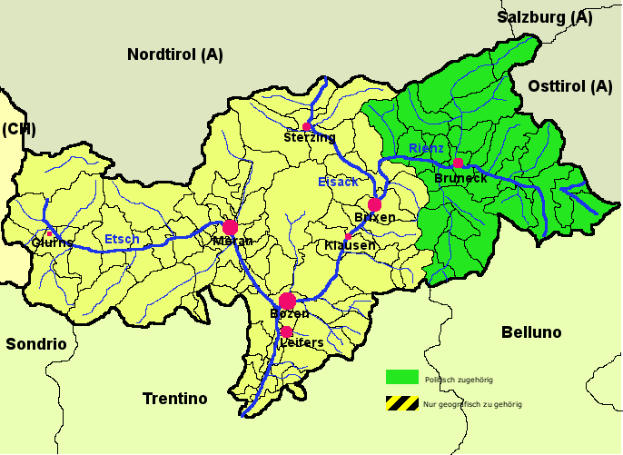
File:Karte Pustertal.png
Appearance
Karte_Pustertal.png (686 × 501 pixels, file size: 46 KB, MIME type: image/png)
File history
Click on a date/time to view the file as it appeared at that time.
| Date/Time | Thumbnail | Dimensions | User | Comment | |
|---|---|---|---|---|---|
| current | 01:14, 7 April 2006 |  | 686 × 501 (46 KB) | Inge-Lyubov~commonswiki | *{{en|South Tyrol, with the Pustertal (Val Pusteria) marked in green}} *{{de|Südtirolkarte mit markiertem Pustertal}} *created by Christoph Federer *Source: de.wikipedia.org: ''<nowiki>01:24, 1. Apr |
File usage
The following 2 pages use this file:
Global file usage
The following other wikis use this file:
- Usage on da.wikipedia.org
- Usage on de.wikipedia.org
- Usage on de.wikivoyage.org
- Usage on el.wikipedia.org
- Usage on eo.wikipedia.org
- Usage on es.wikipedia.org
- Usage on et.wikipedia.org
- Usage on fr.wikipedia.org
- Usage on hu.wikipedia.org
- Usage on it.wikipedia.org
- Rienza
- Val Badia
- Valdaora
- Val Pusteria
- Drava
- Rio Gadera
- Corvara in Badia
- Falzes
- Terento
- Badia (Italia)
- Braies
- Campo Tures
- Chienes
- Dobbiaco
- Gais (Italia)
- La Valle
- Marebbe
- Monguelfo-Tesido
- Perca (Italia)
- Rasun-Anterselva
- San Candido
- San Lorenzo di Sebato
- San Martino in Badia
- Selva dei Molini
- Sesto (comune)
- Valle Aurina
- Valle di Casies
- Vandoies
- Villabassa
- Rio Anterselva
- Rio Braies
- Rio Casies
- Rio di Fundres
- Rio Sesto
- Portale:Alto Adige
- Ferrovia della Val Pusteria
- Portale:Romagna
- Portale:Romagna/Portali collegati
View more global usage of this file.


