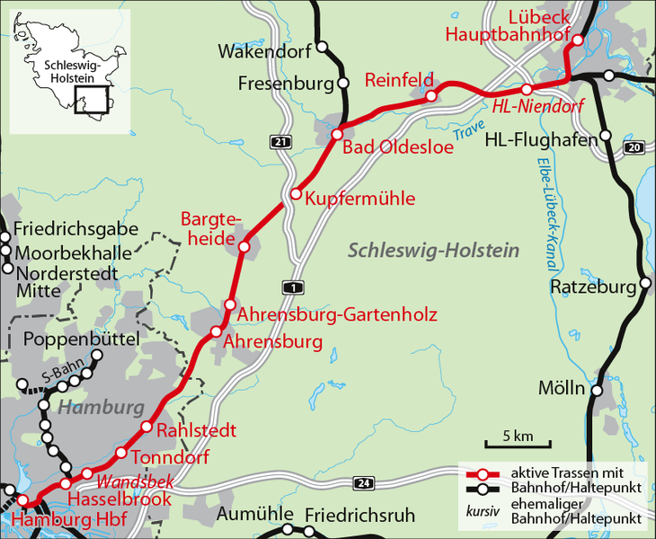
File:Karte Bahnstrecke Lübeck-Hamburg.png
Appearance

Size of this preview: 730 × 600 pixels. Other resolutions: 292 × 240 pixels | 584 × 480 pixels | 803 × 660 pixels.
Original file (803 × 660 pixels, file size: 125 KB, MIME type: image/png)
File history
Click on a date/time to view the file as it appeared at that time.
| Date/Time | Thumbnail | Dimensions | User | Comment | |
|---|---|---|---|---|---|
| current | 16:45, 18 September 2022 |  | 803 × 660 (125 KB) | NordNordWest | upd |
| 09:31, 6 February 2013 |  | 806 × 662 (304 KB) | NordNordWest | upd | |
| 19:53, 6 December 2010 |  | 806 × 662 (298 KB) | NordNordWest | upd | |
| 12:17, 10 June 2008 |  | 806 × 662 (294 KB) | NordNordWest | == Beschreibung == {{Information |Description= {{de|Karte der Bahnstrecke Lübeck–Hamburg}} |Source=own work |Date=10-06-2008 |Author= NordNordWest |Permission= |other_versions= }} {{Kartenwerk |
File usage
The following page uses this file:
Global file usage
The following other wikis use this file:
- Usage on de.wikipedia.org
- Usage on hu.wikipedia.org
- Usage on ja.wikipedia.org
- Usage on no.wikipedia.org
- Usage on tr.wikipedia.org
- Usage on www.wikidata.org


