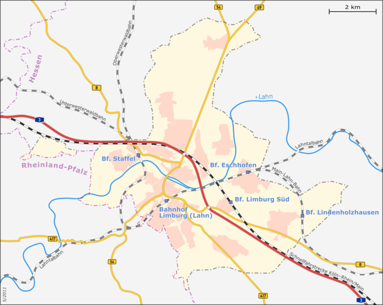
File:Karte-Limburg-mit-Verkehrsadern.png
Appearance

Size of this preview: 752 × 600 pixels. Other resolutions: 301 × 240 pixels | 602 × 480 pixels | 963 × 768 pixels | 1,280 × 1,021 pixels | 1,600 × 1,276 pixels.
Original file (1,600 × 1,276 pixels, file size: 486 KB, MIME type: image/png)
File history
Click on a date/time to view the file as it appeared at that time.
| Date/Time | Thumbnail | Dimensions | User | Comment | |
|---|---|---|---|---|---|
| current | 12:37, 1 May 2011 |  | 1,600 × 1,276 (486 KB) | Muns | optisch aufgeräumt, vgl. Diskussion in der Kartenwerkstatt: angrenzende Gemeinden weggelassen, Beschriftungen reduziert, Schriften verkleinert, etc. |
| 22:01, 27 April 2011 |  | 1,600 × 1,276 (583 KB) | Muns | {{Information |Description={{en|1=Map of Limburg an der Lahn's city districts + main streets and railway}} {{de|1=Karte der Limburger Stadtteile mit Hauptverkehrsadern}} This map was created from OpenStreetMap project data, collected by the communit |
File usage
The following 2 pages use this file:
Global file usage
The following other wikis use this file:
- Usage on arz.wikipedia.org
- Usage on de.wikipedia.org
- Usage on ja.wikipedia.org
- Usage on nl.wikipedia.org
- Usage on sw.wikipedia.org
- Usage on www.wikidata.org


