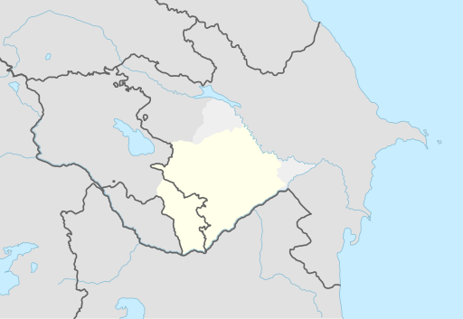
File:Karabakh-Map.svg
Appearance

Size of this PNG preview of this SVG file: 512 × 353 pixels. Other resolutions: 320 × 221 pixels | 640 × 441 pixels | 1,024 × 706 pixels | 1,280 × 883 pixels | 2,560 × 1,765 pixels.
Original file (SVG file, nominally 512 × 353 pixels, file size: 97 KB)
File history
Click on a date/time to view the file as it appeared at that time.
| Date/Time | Thumbnail | Dimensions | User | Comment | |
|---|---|---|---|---|---|
| current | 06:45, 23 May 2022 |  | 512 × 353 (97 KB) | Suffocation88 | Changed historical area colors, removing hatched lines per international recognition. This map just shows the area. |
| 16:20, 9 March 2021 |  | 512 × 353 (170 KB) | Golden | weird to not include all parts of Kalbajar in Karabakh; the panhandle has been part of the region for most of its history (existed during Russian Empire times) | |
| 16:17, 9 March 2021 |  | 512 × 353 (170 KB) | Golden | fix | |
| 16:15, 9 March 2021 |  | 512 × 356 (171 KB) | Golden | update NKR borders | |
| 12:46, 17 May 2018 |  | 1,358 × 935 (232 KB) | Kentronhayastan | User created page with UploadWizard |
File usage
The following page uses this file:
Global file usage
The following other wikis use this file:
- Usage on az.wikipedia.org
- Usage on be.wikipedia.org
- Usage on bn.wikipedia.org
- Usage on ca.wikipedia.org
- Usage on es.wikipedia.org
- Usage on eu.wikipedia.org
- Usage on fa.wikipedia.org
- Usage on fr.wikipedia.org
- Usage on hy.wikipedia.org
- Usage on id.wikipedia.org
- Usage on lv.wikipedia.org
- Usage on ms.wikipedia.org
- Usage on nl.wikipedia.org
- Usage on pt.wikipedia.org
- Usage on ro.wikipedia.org
- Usage on sr.wikipedia.org
- Usage on www.wikidata.org


