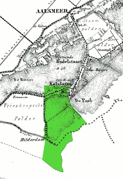
File:Kalslagen en Bilderdam.png
Appearance

Size of this preview: 410 × 599 pixels. Other resolutions: 164 × 240 pixels | 585 × 855 pixels.
Original file (585 × 855 pixels, file size: 76 KB, MIME type: image/png)
File history
Click on a date/time to view the file as it appeared at that time.
| Date/Time | Thumbnail | Dimensions | User | Comment | |
|---|---|---|---|---|---|
| current | 17:11, 27 April 2010 |  | 585 × 855 (76 KB) | Eugene van der Pijll | Cropped |
| 17:05, 27 April 2010 |  | 1,400 × 1,786 (219 KB) | Eugene van der Pijll | {{Information |Description=Municipality of Kalslagen en Bilderdam, on a 1868 map of Aalsmeer |Source=From kadaster maps (http://watwaswaar.nl/#Rk-YK-7-1-1v-1-2nmw-2IeS---1MN); background map is from Kuyper's Gemeente Atlas van Nederland |Date=xyz |Author= |
File usage
The following page uses this file:
