Jump to content

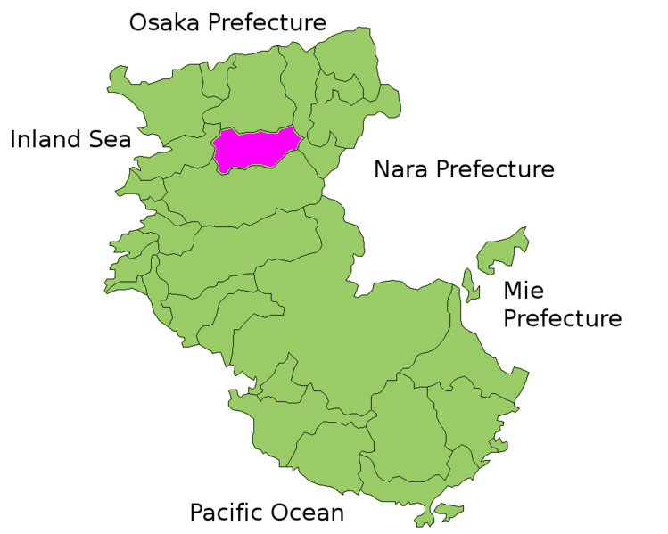
File:Kaisou District Map.png

Page contents not supported in other languages.
This is a file from the Wikimedia Commons
From Wikipedia, the free encyclopedia

Kaisou_District_Map.png (749 × 599 pixels, file size: 89 KB, MIME type: image/png)

Summary

Description Map of Kaisou District, Wakayama Prefecture, Japan
Date 20 October 2006 (original upload date)
Source

Transferred from nl.wikipedia to Commons.

(Original text: own work)
Author

The original uploader was Krisgrotius at Dutch Wikipedia.

(Original text: nl:Gebruiker:Krisgrotius)

Licensing

Shigenobu AOKI, the copyright holder of this work, allows anyone to use it for any purpose including unrestricted redistribution, commercial use, and modification.

Original upload log

The original description page was here. All following user names refer to nl.wikipedia.
  • 2006-10-20 14:34 Krisgrotius 749×599×8 (90739 bytes) {{Information| |Description= Map of Kaisou District, Wakayama Prefecture, Japan |Source= own work |Date= |Author= ~~~~ |Permission= public |other_versions= }}

Captions

Add a one-line explanation of what this file represents

Items portrayed in this file

depicts

20 October 2006

90,739 byte

599 pixel

749 pixel

image/png

38054f9c365fff775ec80372419a50cfa7078386

File history

Click on a date/time to view the file as it appeared at that time.

Date/TimeThumbnailDimensionsUserComment
current22:48, 22 March 2007Thumbnail for version as of 22:48, 22 March 2007749 × 599 (89 KB)SieBot {{Information |Description=Map of Kaisou District, Wakayama Prefecture, Japan |Source=Originally from [http://nl.wikipedia.org nl.wikipedia]; description page is/was [http://nl.wikipedia.org/w/index.php?title=Image%3AKaisou_District_Map.png here].<br/> (

The following page uses this file: