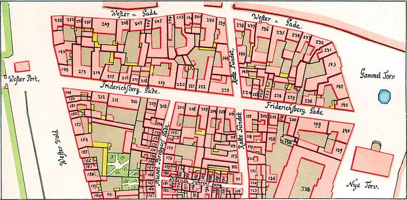
File:Københavnsbrand1728-vester-kvarter3.jpg
Appearance

Size of this preview: 800 × 393 pixels. Other resolutions: 320 × 157 pixels | 640 × 314 pixels | 1,024 × 503 pixels | 1,280 × 629 pixels | 2,428 × 1,193 pixels.
Original file (2,428 × 1,193 pixels, file size: 2 MB, MIME type: image/jpeg)
File history
Click on a date/time to view the file as it appeared at that time.
| Date/Time | Thumbnail | Dimensions | User | Comment | |
|---|---|---|---|---|---|
| current | 14:00, 7 October 2005 |  | 2,428 × 1,193 (2 MB) | Heelgrasper | Map of Vester Kvarter in Copenhagen after the fire in 1728. The map is based on Christian Geddes map fra 1757. The map is scanned from ''Kjøbenhavns Huse og Indvaanere efter Branden 1728'', København 1906. The text in the book seem to be writen by G.L. |
File usage
The following page uses this file:
Global file usage
The following other wikis use this file:
- Usage on da.wikipedia.org
- Usage on es.wikipedia.org
- Usage on ja.wikipedia.org
- Usage on no.wikipedia.org
- Usage on pt.wikipedia.org
- Usage on sl.wikipedia.org
