Jump to content

File:John E. Weyss05.jpg

Page contents not supported in other languages.
This is a file from the Wikimedia Commons
From Wikipedia, the free encyclopedia

Original file (1,163 × 938 pixels, file size: 294 KB, MIME type: image/jpeg)

Summary

Description
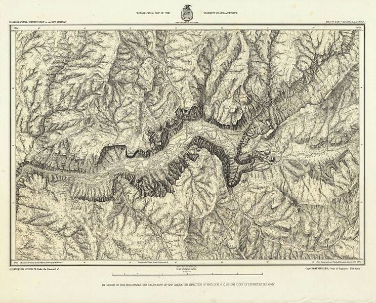
English: "Topographical Map Of The Yosemite Valley And Vicinity", Part Of East Central California. Mountain Drawing by J.E. Weyss; Lettering by J. Franke. Julius Bien & Co. Photo. lith. Expeditions Of 1878-79, Under the Command of Capt. Geo. M. Wheeler, Corps of Engineers, U.S. Army. U.S. Geographical Surveys West Of The 100th Meridian.Author: Wheeler, 1883. This first detailed survey of Yosemite Valley shows interesting cultural features in the valley, many of which no longer exist. The steep valley cliffs are shown with a map style of the 19th century called hachuring - closely spaced lines to indicate slope. It was published separately and as part of the Topographical Atlas ... West of the 100th Meridian of Longitude also known as the Wheeler Survey, one of the most important of the U.S. Army survey's of the American West in the late 19th century.
Date
Source http://www.davidrumsey.com/maps5597.html
Author John E. Weyss (1820-1903)

Licensing

Public domain

This work is in the public domain in its country of origin and other countries and areas where the copyright term is the author's life plus 100 years or fewer.


You must also include a United States public domain tag to indicate why this work is in the public domain in the United States.
This file has been identified as being free of known restrictions under copyright law, including all related and neighboring rights.

Captions

Add a one-line explanation of what this file represents

Items portrayed in this file

depicts

File history

Click on a date/time to view the file as it appeared at that time.

Date/TimeThumbnailDimensionsUserComment
current13:15, 17 June 2012Thumbnail for version as of 13:15, 17 June 20121,163 × 938 (294 KB)Paul venter{{Information |Description ={{en|1="Topographical Map Of The Yosemite Valley And Vicinity", Part Of East Central California. Mountain Drawing by J.E. Weyss; Lettering by J. Franke. Julius Bien & Co. Photo. lith. Expeditions Of 1878-79, Under the Com...

The following page uses this file:

Metadata