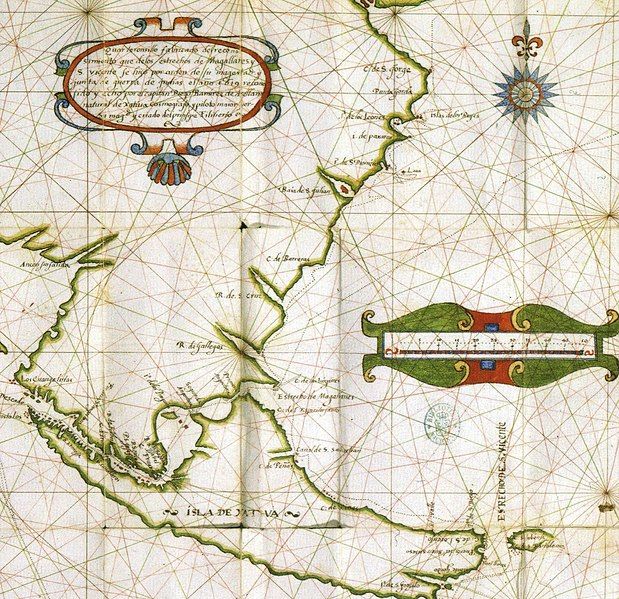
File:Illa de Xàtiva.jpg
Appearance

Size of this preview: 619 × 599 pixels. Other resolutions: 248 × 240 pixels | 496 × 480 pixels | 793 × 768 pixels | 1,057 × 1,024 pixels | 2,275 × 2,203 pixels.
Original file (2,275 × 2,203 pixels, file size: 1.5 MB, MIME type: image/jpeg)
File history
Click on a date/time to view the file as it appeared at that time.
| Date/Time | Thumbnail | Dimensions | User | Comment | |
|---|---|---|---|---|---|
| current | 17:33, 22 July 2015 |  | 2,275 × 2,203 (1.5 MB) | Mcapdevila | Map in color of Diego Ramírez de Arellano depicting the actual Island of Tierra de Fuego with the name of Illa de Xàtiva, after he did circumnavigated an chartered the whole island for the very first time. |
| 08:43, 21 June 2007 |  | 250 × 187 (13 KB) | Pere prlpz | {{Information |Description={{ca|Mapa de ca:Diego Ramírez de Arellano amb l'ca:Illa de Xàtiva, actualment Tierra de Fuego}} |Source=Web del diari Levante http://www.levante-emv.com/secciones/noticia.jsp?pNumEjemplar=3562&pIdSeccion=9&pIdNot |
File usage
The following page uses this file:
Global file usage
The following other wikis use this file:
- Usage on ca.wikipedia.org
- Usage on es.wikipedia.org
- Usage on he.wikipedia.org
