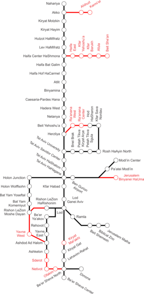
File:IRfuturemap.png
Appearance

Size of this preview: 295 × 599 pixels. Other resolutions: 118 × 240 pixels | 236 × 480 pixels | 378 × 768 pixels | 1,248 × 2,536 pixels.
Original file (1,248 × 2,536 pixels, file size: 387 KB, MIME type: image/png)
File history
Click on a date/time to view the file as it appeared at that time.
| Date/Time | Thumbnail | Dimensions | User | Comment | |
|---|---|---|---|---|---|
| current | 13:06, 28 October 2011 |  | 1,248 × 2,536 (387 KB) | Ynhockey | Updating PNG version per SVG changes |
| 09:38, 4 April 2008 |  | 1,133 × 2,439 (402 KB) | Ynhockey | {{Information |Description=Israel Railways line map for the near future - in black are existing lines and stations, while in red are lines and stations either under construction, or in advanced planning stages. |Source=self-made |Date=2008-04-04 |Author=[ |
File usage
The following page uses this file:
Global file usage
The following other wikis use this file:
- Usage on no.wikipedia.org
- Usage on pl.wikipedia.org
