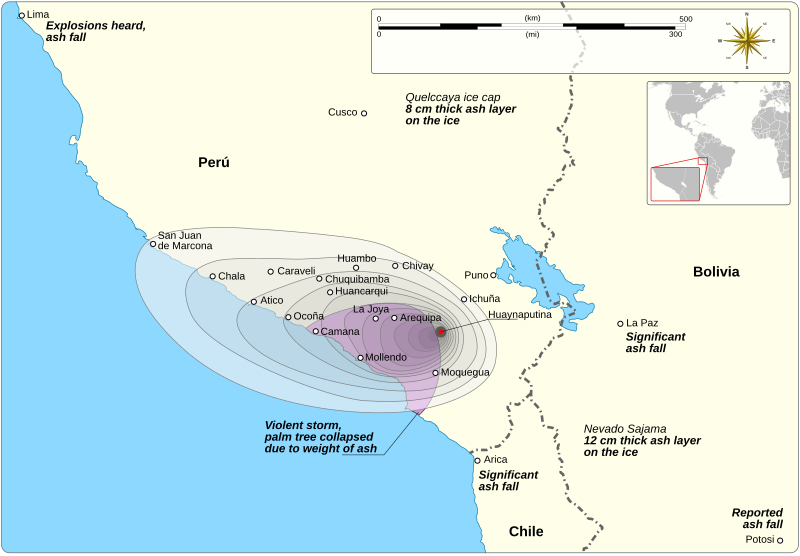
File:Huaynaputina tephra fallout.svg
Appearance

Size of this PNG preview of this SVG file: 800 × 555 pixels. Other resolutions: 320 × 222 pixels | 640 × 444 pixels | 1,024 × 711 pixels | 1,280 × 888 pixels | 2,560 × 1,777 pixels | 1,239 × 860 pixels.
Original file (SVG file, nominally 1,239 × 860 pixels, file size: 696 KB)
File history
Click on a date/time to view the file as it appeared at that time.
| Date/Time | Thumbnail | Dimensions | User | Comment | |
|---|---|---|---|---|---|
| current | 17:46, 21 June 2021 |  | 1,239 × 860 (696 KB) | Goran tek-en | {{Information |description ={{en|Tephra fallout map of Huaynaputina's 1600 eruption.}} |date =2021-06-21 |source ={{Own}}<br> {{Derived from|Maps template-en.svg|BlankMap-World gray.svg}} Derived from; * [https://www.openstreetmap.org/search?whereami=1&query=-14.286%2C-71.104#map=7/-14.291/-71.098 OSM] Information from: * [https://www.researchgate.net/figure/Location-map-shows-the-regional-context-of-Volcn-Huaynaputina-The-triangles-are-the_fig1_226447770 Fig 1] * [htt... |
File usage
The following page uses this file:


