Jump to content

File:Holy Island (Overview).jpg

Page contents not supported in other languages.
This is a file from the Wikimedia Commons
From Wikipedia, the free encyclopedia

Original file (4,512 × 3,024 pixels, file size: 7.21 MB, MIME type: image/jpeg)

Summary

Description
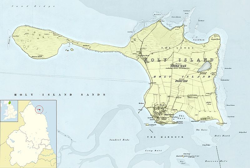
Deutsch: Kartenausschnitt nach einer Seekarte der britischen Marine aus dem Jahr 1866
English: Map section after a nautical map of the British Navy from 1866
Français : Section de la carte après une carte nautique de la marine britannique de 1866
Date
Source

Own work under the use of the file Northumberland_UK_constituency_map_(blank).svg

based on the following document:
Northumberland XII (includes: Elwick; Holy Island; Kyloe; Ross.) National Library of Scotland
Author
Other versions


This is a retouched picture, which means that it has been digitally altered from its original version. Modifications: Bildzusammenstellung aus verschiedenen Bildschirmfotos; Bildzuschnitt (Vielfaches von 16 px); Kolorierung; Photoshop Speicheroptionen: Qualität 12. Modifications made by MagentaGreen.

Licensing

w:en:Creative Commons
attribution share alike
This file is licensed under the Creative Commons Attribution-Share Alike 3.0 Unported license.
You are free:
  • to share – to copy, distribute and transmit the work
  • to remix – to adapt the work
Under the following conditions:
  • attribution – You must give appropriate credit, provide a link to the license, and indicate if changes were made. You may do so in any reasonable manner, but not in any way that suggests the licensor endorses you or your use.
  • share alike – If you remix, transform, or build upon the material, you must distribute your contributions under the same or compatible license as the original.

Captions

Add a one-line explanation of what this file represents

Items portrayed in this file

depicts

23 June 2016

7,560,421 byte

3,024 pixel

4,512 pixel

image/jpeg

4c10cd62a0076ba42244e957e62f2349ed47c980

File history

Click on a date/time to view the file as it appeared at that time.

Date/TimeThumbnailDimensionsUserComment
current16:05, 2 July 2016Thumbnail for version as of 16:05, 2 July 20164,512 × 3,024 (7.21 MB)MagentaGreen=={{int:filedesc}}== {{Information |description={{de|1=Kartenausschnitt nach einer Seekarte der britischen Marine aus dem Jahr 1866}}{{en|1=Map section after a nautical map of the British Navy from 1866}}{{fr|1=Section de la carte après une carte naut...

The following page uses this file:

Global file usage

The following other wikis use this file: