Jump to content

File:Hogback Bridge.jpg

Page contents not supported in other languages.
This is a file from the Wikimedia Commons
From Wikipedia, the free encyclopedia

Hogback_Bridge.jpg (766 × 519 pixels, file size: 40 KB, MIME type: image/jpeg)

This is an image of a place or building that is listed on the National Register of Historic Places in the United States of America. Its reference number is 88000848.

Camera location40° 58′ 25″ N, 78° 29′ 26″ W Kartographer map based on OpenStreetMap.View this and other nearby images on: OpenStreetMapinfo
Description
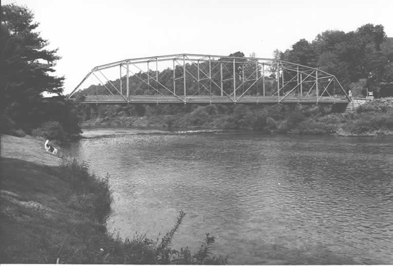
English: Side of the Hogback Bridge, which carries Legislative Route 869 over the West Branch of the Susquehanna River near Curwensville in Lawrence Township, Clearfield County, Pennsylvania, United States. Built in 1893, this Pennsylvania petit truss bridge is listed on the National Register of Historic Places.
Date
Source "Hogback Bridge" (National Register of Historic Places form). National Park Service (June 22, 1988). Photo from http://www.arch.state.pa.us, searchable database, at http://www.arch.state.pa.us/images/hires/H000059_01B.jpg
Author PennDOT
Permission
(Reusing this file)
An employee of the Pennsylvania Department of Transportation (Penn DOT) took this image, apparently in 1982, expressly for potential submission to the National Register of Historic Places. See page 16 (of 47) in the PDF for the "Pennsylvania Department of Transportation Owned Highway Bridges" Multiple Property Submission here: "During 1982 personnel from each of Penn DOT's eleven engineering districts were trained and dispatched to photograph and gather basic structural data for each of the 1,635 bridges." These images are considered by Penn DOT to be in the public domain.
VRT Wikimedia

This work is free and may be used by anyone for any purpose. If you wish to use this content, you do not need to request permission as long as you follow any licensing requirements mentioned on this page.

The Wikimedia Foundation has received an e-mail confirming that the copyright holder has approved publication under the terms mentioned on this page. This correspondence has been reviewed by a Volunteer Response Team (VRT) member and stored in our permission archive. The correspondence is available to trusted volunteers as ticket #2009021710064701.

If you have questions about the archived correspondence, please use the VRT noticeboard. Ticket link: https://ticket.wikimedia.org/otrs/index.pl?Action=AgentTicketZoom&TicketNumber=2009021710064701
Find other files from the same ticket: SDC query (SPARQL)


Public domain This work has been released into the public domain by its copyright holder, Pennsylvania Department of Transportation. This applies worldwide.
In some countries this may not be legally possible; if so:
Pennsylvania Department of Transportation grants anyone the right to use this work for any purpose, without any conditions, unless such conditions are required by law.

Captions

Add a one-line explanation of what this file represents

Items portrayed in this file

depicts

40°58'25.000"N, 78°29'26.002"W

File history

Click on a date/time to view the file as it appeared at that time.

Date/TimeThumbnailDimensionsUserComment
current04:11, 21 December 2009Thumbnail for version as of 04:11, 21 December 2009766 × 519 (40 KB)Nyttend{{Location|40|58|25|N|78|29|26|W}} {{Information |Description={{en|Side of the {{w|Hogback Bridge}}, which carries Legislative Route 869 over the {{w|West Branch Susquehanna River|West Branch}} of the {{w|Susquehanna River}} near {{w|Curwensville, Pennsyl

Global file usage

Metadata