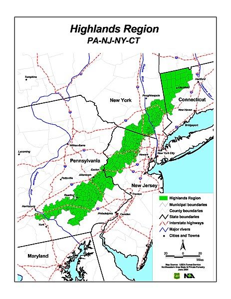
File:HighlandsConnecticutNewJerseyNewYorkPennsylvaniaMap.jpg
Appearance

Size of this preview: 463 × 599 pixels. Other resolutions: 185 × 240 pixels | 371 × 480 pixels | 593 × 768 pixels | 791 × 1,024 pixels | 2,550 × 3,300 pixels.
Original file (2,550 × 3,300 pixels, file size: 529 KB, MIME type: image/jpeg)
File history
Click on a date/time to view the file as it appeared at that time.
| Date/Time | Thumbnail | Dimensions | User | Comment | |
|---|---|---|---|---|---|
| current | 21:20, 20 June 2010 |  | 2,550 × 3,300 (529 KB) | Kcboling | {{Information |Description={{en|1=Map of the Highlands Region of Connecticut, New Jersey, New York, and Pennsylvania }} |Source=http://na.fs.fed.us/highlands/maps_pubs/index.shtm |Author=U.S. Forest Service |Date=2004-06-01 |Permission= |other_versions= } |
File usage
The following page uses this file:

