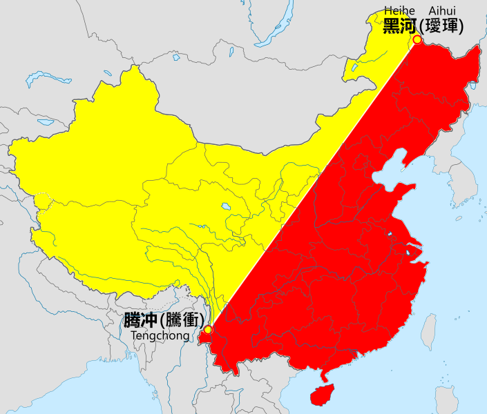
File:Heihe-tengchong-line.svg
Appearance

Size of this PNG preview of this SVG file: 705 × 599 pixels. Other resolutions: 282 × 240 pixels | 565 × 480 pixels | 904 × 768 pixels | 1,205 × 1,024 pixels | 2,409 × 2,048 pixels | 1,000 × 850 pixels.
Original file (SVG file, nominally 1,000 × 850 pixels, file size: 216 KB)
File history
Click on a date/time to view the file as it appeared at that time.
| Date/Time | Thumbnail | Dimensions | User | Comment | |
|---|---|---|---|---|---|
| current | 08:55, 31 August 2019 |  | 1,000 × 850 (216 KB) | QuYi96 | 設色改正。台灣實際未受中華人民共和國政權控制,影響人口分佈的主要社會因素大不相同,且分屬於不同脈絡;因此在人口地理學的研究及理論的適用範圍應該小心區分。 |
| 08:32, 31 August 2019 |  | 1,000 × 850 (220 KB) | QuYi96 | 設色改正。台灣實際未受中華人民共和國政權控制,影響人口分佈的主要社會因素大不相同,且分屬於不同脈絡;因此在人口地理學的研究及理論的適用範圍應該小心區分。 | |
| 12:15, 14 February 2016 |  | 1,000 × 850 (221 KB) | Ginbayashi | 文字图形化 | |
| 12:13, 14 February 2016 |  | 1,000 × 850 (200 KB) | Ginbayashi | 更新地图及文字标注 | |
| 13:58, 4 September 2009 |  | 728 × 608 (28 KB) | PhiLiP | The definition of Heihe-Tengchong-line defined by Hu Huanyong at 1987 contains Taiwan as a part of China but exclude Mongolia. | |
| 05:13, 19 August 2009 |  | 728 × 608 (29 KB) | Jjhcap99 | Reverted to version as of 07:10, 11 May 2009 | |
| 23:18, 13 May 2009 |  | 728 × 608 (28 KB) | Shibo77 | Reverted to version as of 01:47, 24 April 2009 黑腾线的面积、人口数据包括台澎金马 | |
| 07:10, 11 May 2009 |  | 728 × 608 (29 KB) | Jjhcap99 | Reverted to version as of 01:30, 12 July 2008 | |
| 01:47, 24 April 2009 |  | 728 × 608 (28 KB) | Shibo77 | Reverted to version as of 17:19, 8 March 2008 | |
| 01:30, 12 July 2008 |  | 728 × 608 (29 KB) | Jjhcap99 | Taiwan is not part of PRC. |
File usage
The following 4 pages use this file:
Global file usage
The following other wikis use this file:
- Usage on cs.wikipedia.org
- Usage on de.wikipedia.org
- Usage on el.wikipedia.org
- Usage on es.wikipedia.org
- Usage on eu.wikipedia.org
- Usage on fr.wikipedia.org
- Usage on gl.wikipedia.org
- Usage on hi.wikipedia.org
- Usage on hu.wikipedia.org
- Usage on id.wikipedia.org
- Usage on it.wikipedia.org
- Usage on ja.wikipedia.org
- Usage on no.wikipedia.org
- Usage on pt.wikipedia.org
- Usage on ru.wikipedia.org
- Usage on tr.wikipedia.org
- Usage on uk.wikipedia.org
- Usage on www.wikidata.org
- Usage on zh.wikipedia.org
