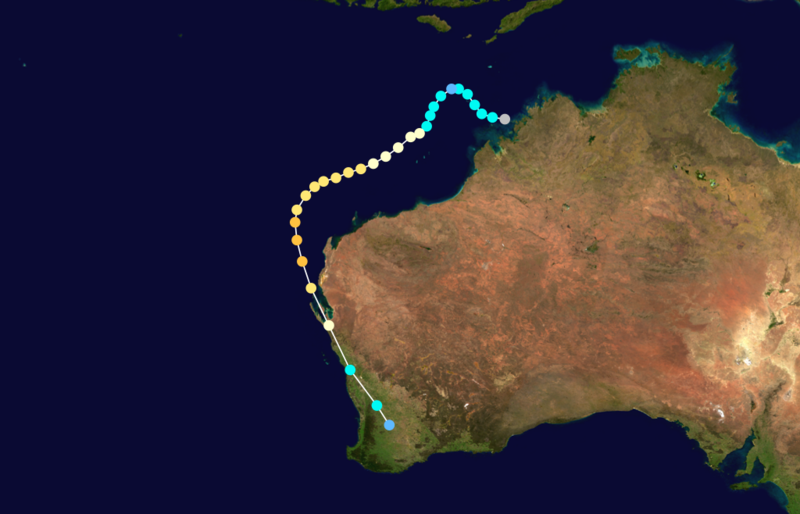
File:Hazel 1979 track.png
Appearance

Size of this preview: 800 × 514 pixels. Other resolutions: 320 × 206 pixels | 640 × 411 pixels | 1,024 × 658 pixels.
Original file (1,024 × 658 pixels, file size: 522 KB, MIME type: image/png)
File history
Click on a date/time to view the file as it appeared at that time.
| Date/Time | Thumbnail | Dimensions | User | Comment | |
|---|---|---|---|---|---|
| current | 17:51, 2 January 2010 |  | 1,024 × 658 (522 KB) | Iune | uploaded with 1-min winds now |
| 17:40, 2 January 2010 |  | 1,024 × 658 (522 KB) | Iune | {{Information |Description={{en|Track map of Severe Tropical Cyclone Hazel of the 1978-79 Australian region season. The points show the location of the storm at 6-hour intervals. The colour represents the storm's [[:w:maximum sustained wind|maximum sustai |
File usage
The following page uses this file:
