File:H1N1 Guatemala Map.svg
Appearance

Size of this PNG preview of this SVG file: 440 × 452 pixels. Other resolutions: 234 × 240 pixels | 467 × 480 pixels | 748 × 768 pixels | 997 × 1,024 pixels | 1,994 × 2,048 pixels.
Original file (SVG file, nominally 440 × 452 pixels, file size: 97 KB)
File history
Click on a date/time to view the file as it appeared at that time.
| Date/Time | Thumbnail | Dimensions | User | Comment | |
|---|---|---|---|---|---|
| current | 03:58, 27 June 2009 |  | 440 × 452 (97 KB) | Vrysxy | Actualizando al 25 de junio conforme a la OPS http://ais.paho.org/flu/sm/atlas.html |
| 00:51, 16 June 2009 |  | 440 × 452 (97 KB) | Vrysxy | Las muertes se dieron en el departamento de Guatemala según la OPS http://ais.paho.org/flu/sm/atlas.html | |
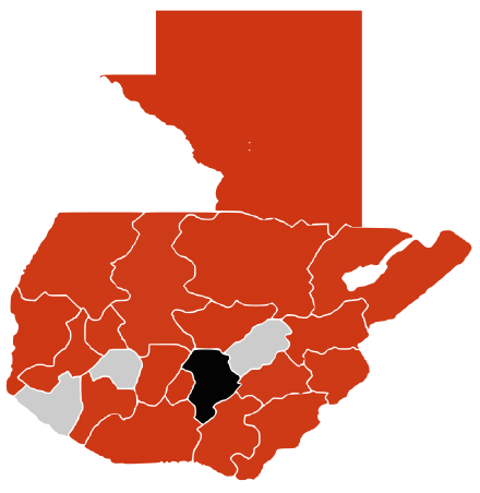
| 20:37, 12 June 2009 |  | 440 × 452 (97 KB) | Vrysxy | {{Information |Description={{es|1=Un mapa sobre el brote de gripe A (H1N1) en Guatemala de 2009 <br /> {{legend|#000000|muertes confirmadas}} {{legend|#cd3412|casos confirmados}} {{legend|#eaa912|casos sin confirmar}}}} {{en|1=A map about the 2009 A (H1N1 |
File usage
The following page uses this file:
Global file usage
The following other wikis use this file:
- Usage on fr.wikipedia.org
- Usage on nl.wikipedia.org
- Usage on pl.wikipedia.org

