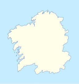
File:Galicia location map.svg
Appearance

Size of this PNG preview of this SVG file: 257 × 271 pixels. Other resolutions: 228 × 240 pixels | 455 × 480 pixels | 728 × 768 pixels | 971 × 1,024 pixels | 1,942 × 2,048 pixels.
Original file (SVG file, nominally 257 × 271 pixels, file size: 34 KB)
File history
Click on a date/time to view the file as it appeared at that time.
| Date/Time | Thumbnail | Dimensions | User | Comment | |
|---|---|---|---|---|---|
| current | 00:19, 30 January 2010 |  | 257 × 271 (34 KB) | Sobreira | no Garamond no Courier, only borders |
| 00:18, 30 January 2010 |  | 257 × 271 (34 KB) | Sobreira | Courier (It seemed Garamond was not readable) | |
| 00:16, 30 January 2010 |  | 257 × 271 (35 KB) | Sobreira | with name and border | |
| 23:52, 29 January 2010 |  | 257 × 271 (32 KB) | Sobreira | {{Information |Description={{en|1=Map for locating places within Galicia}} {{gl|1=Mapa mudo para situar lugares en Galiza}} {{fr|1=Map sans noms pour placer lieus a la Galice}} {{es|1=Mapa de localización de lugares en Galicia}} {{pt|1=mapa para |
File usage
No pages on the English Wikipedia use this file (pages on other projects are not listed).
Global file usage
The following other wikis use this file:
- Usage on de.wikipedia.org
- Usage on gl.wikipedia.org
