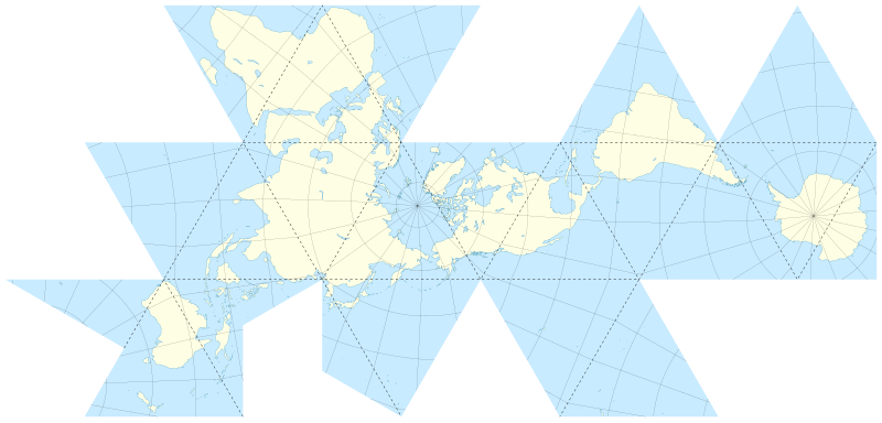
File:Fuller projection.svg
Appearance

Size of this PNG preview of this SVG file: 800 × 383 pixels. Other resolutions: 320 × 153 pixels | 640 × 307 pixels | 1,024 × 491 pixels | 1,280 × 613 pixels | 2,560 × 1,226 pixels | 1,670 × 800 pixels.
Original file (SVG file, nominally 1,670 × 800 pixels, file size: 736 KB)
File history
Click on a date/time to view the file as it appeared at that time.
| Date/Time | Thumbnail | Dimensions | User | Comment | |
|---|---|---|---|---|---|
| current | 14:11, 8 May 2009 |  | 1,670 × 800 (736 KB) | Sting | Competely new version using GIS data and software for the projection |
| 00:29, 24 September 2006 |  | 1,370 × 680 (628 KB) | Sting | Great Britain better rendering | |
| 18:59, 17 September 2006 |  | 1,370 × 680 (627 KB) | Sting | Dot lines | |
| 17:33, 17 September 2006 |  | 1,370 × 680 (627 KB) | Sting | {{Information |Description=Map of the world with a Fuller projection, also known as ''Dymaxion'', with folding lines |Source=Own work |Date=translation : September 2006 |Author=Eric Gaba (Sting) |Permission=CC-BY-SA-2.5 |other_versions=repr |
File usage
The following 4 pages use this file:
Global file usage
The following other wikis use this file:
- Usage on az.wikiquote.org
- Usage on ca.wikipedia.org
- Usage on en.wikiquote.org
- Usage on es.wikipedia.org
- Usage on fr.wikipedia.org
- Usage on hu.wikipedia.org
- Usage on id.wikipedia.org
- Usage on it.wikipedia.org
- Usage on ja.wikipedia.org
- Usage on nl.wikipedia.org
- Usage on no.wikipedia.org
- Usage on pt.wikipedia.org
- Usage on uk.wikipedia.org

