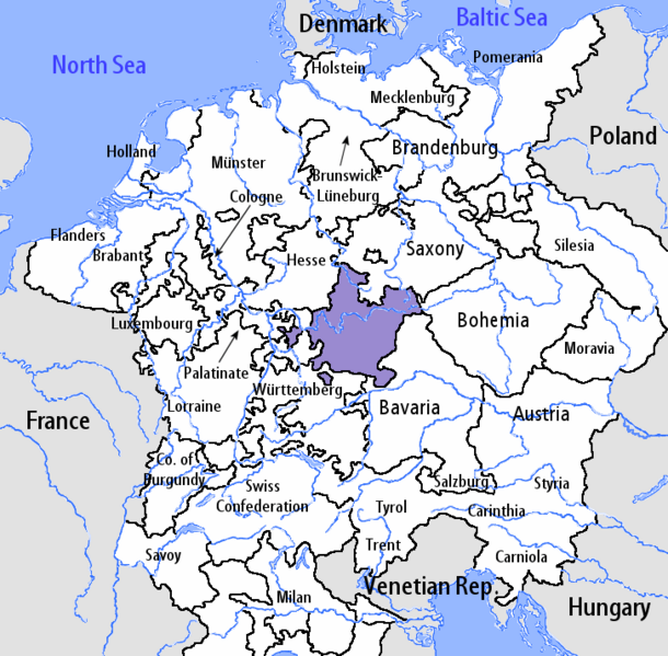
File:Franconian Circle-2005-10-15-en.png
Appearance

Size of this preview: 610 × 599 pixels. Other resolutions: 244 × 240 pixels | 489 × 480 pixels | 727 × 714 pixels.
Original file (727 × 714 pixels, file size: 67 KB, MIME type: image/png)
File history
Click on a date/time to view the file as it appeared at that time.
| Date/Time | Thumbnail | Dimensions | User | Comment | |
|---|---|---|---|---|---|
| current | 11:27, 7 August 2006 |  | 727 × 714 (67 KB) | Loveless | This image was copied from wikipedia:fr. The original description was: == Sommaire == fr::en:User:Silverhelm is the author of this image file. Its contents are based in part on a map published in the "Historical Atlas" by Prof. William R Shepherd, |
File usage
The following page uses this file:
Global file usage
The following other wikis use this file:
- Usage on azb.wikipedia.org
- Usage on de.wikipedia.org
- Schweinfurt
- Rothenburg ob der Tauber
- Herzogtum Sachsen-Meiningen
- Hohenlohe (Adelsgeschlecht)
- Weißenburg in Bayern
- Welzheim
- Aub
- Waldenburg (Württemberg)
- Grafschaft Henneberg
- Bad Windsheim
- Hochstift Würzburg
- Fränkischer Reichskreis
- Deutschordensballei Franken
- Schenken von Limpurg
- Fürstentum Ansbach
- Fürstentum Bayreuth
- Hochstift Bamberg
- Grafschaft Gimborn
- Löwenstein-Wertheim
- Erbach (Adelsgeschlecht)
- Hausen (hessisches Adelsgeschlecht)
- Hochstift Eichstätt
- Bistum Eichstätt
- Grafschaft Castell
- Grafschaft Rieneck
- Reichsstadt Nürnberg
- Vorlage:Navigationsleiste Fränkischer Reichskreis
- Herrschaft Wiesentheid
- Usage on it.wikipedia.org
- Usage on no.wikipedia.org
- Usage on th.wikipedia.org
