Jump to content

File:Fort-Sullivan.jpg

Page contents not supported in other languages.
This is a file from the Wikimedia Commons
From Wikipedia, the free encyclopedia

Original file (1,500 × 1,146 pixels, file size: 295 KB, MIME type: image/jpeg)

Summary

Description
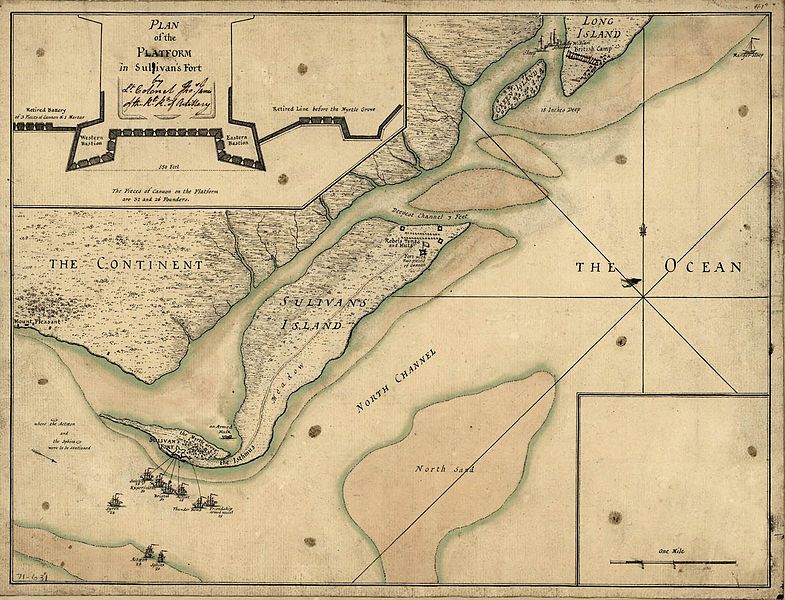
English: Engraving of a sketch of the 1776 Battle of Sullivan's Island, made by a British Army officer. Caption reads: A plan of the attack of Fort Sulivan, near Charles Town in South Carolina by a squadron of His Majesty's ships on the 28th day of June 1776, with the disposition of the King's land forces and the encampments and entrenchments of the rebels, from the drawings made on the spot.
Date

  • 28 June 2008 (according to Exif data)
Source

Library of Congress Prints and Photographs Division Washington, D.C. 20540 USA: http://hdl.loc.gov/loc.gmd/g3914c.ar154400

Author

Thos. James of the Rl. Rt. of Artillery; engraving by William Faden

Uploaded by Az81964444 at en.wikipedia

Licensing

Public domain

This work is in the public domain in its country of origin and other countries and areas where the copyright term is the author's life plus 100 years or fewer.


This work is in the public domain in the United States because it was published (or registered with the U.S. Copyright Office) before January 1, 1930.

This file has been identified as being free of known restrictions under copyright law, including all related and neighboring rights.

Original upload log

The original description page was here. All following user names refer to en.wikipedia.

Upload date | User | Bytes | Dimensions | Comment

  • 2010-05-13 09:06 (UTC) | Az81964444 | 301713 (bytes) | 1500×1146 | {{Information |Description = The map of the Battle of Fort Sullivan beween British and American forces in 1776. Continental Army creation |Source = Library of Congress Prints and Photographs Division Washington, D.C. 20540 USA |Date

Captions

Add a one-line explanation of what this file represents

Items portrayed in this file

depicts

File history

Click on a date/time to view the file as it appeared at that time.

Date/TimeThumbnailDimensionsUserComment
current07:49, 22 December 2011Thumbnail for version as of 07:49, 22 December 20111,500 × 1,146 (295 KB)SreeBot(Original text) : {{Information |Description = The map of the Battle of Fort Sullivan beween British and American forces in 1776. Continental Army creation |Source = Library of Congress Prints and Photographs Division Washington, D.C. 20540 U

The following page uses this file:

Global file usage

The following other wikis use this file:

Metadata