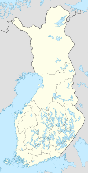
File:Finland location map.svg
Appearance

Size of this PNG preview of this SVG file: 304 × 599 pixels. Other resolutions: 122 × 240 pixels | 243 × 480 pixels | 390 × 768 pixels | 520 × 1,024 pixels | 1,039 × 2,048 pixels | 872 × 1,718 pixels.
Original file (SVG file, nominally 872 × 1,718 pixels, file size: 1.1 MB)
File history
Click on a date/time to view the file as it appeared at that time.
| Date/Time | Thumbnail | Dimensions | User | Comment | |
|---|---|---|---|---|---|
| current | 12:06, 26 January 2021 |  | 872 × 1,718 (1.1 MB) | Fenn-O-maniC | Updated regional borders as per https://asiointi.maanmittauslaitos.fi/karttapaikka/ |
| 10:50, 9 March 2011 |  | 872 × 1,718 (1.07 MB) | NordNordWest | upd | |
| 20:41, 20 January 2010 |  | 872 × 1,536 (1.2 MB) | NordNordWest | update | |
| 18:12, 5 August 2008 |  | 873 × 1,536 (1.07 MB) | NordNordWest | ||
| 11:54, 30 July 2008 |  | 873 × 1,536 (1.01 MB) | NordNordWest | optimized | |
| 18:55, 8 July 2008 |  | 873 × 1,536 (1.33 MB) | NordNordWest | ||
| 14:05, 7 July 2008 |  | 873 × 1,536 (1.28 MB) | NordNordWest | ||
| 19:31, 30 June 2008 |  | 873 × 1,536 (1.38 MB) | NordNordWest | ||
| 20:35, 29 June 2008 |  | 873 × 1,536 (1.38 MB) | NordNordWest | {{Information |Description= {{de|Positionskarte von Finnland}} Quadratische Plattkarte, N-S-Streckung 210 %. Geographische Begrenzung der Karte: * N: 70.4° N * S: 59.5° N * W: 19° W * O: 32° W {{en|Location map of [[:en:Finland|Finlan |
File usage
No pages on the English Wikipedia use this file (pages on other projects are not listed).
Global file usage
The following other wikis use this file:
- Usage on am.wikipedia.org
- Usage on an.wikipedia.org
- Usage on arz.wikipedia.org
- Usage on av.wikipedia.org
- Usage on bg.wikipedia.org
- Usage on bs.wikipedia.org
- Usage on ca.wikipedia.org
- Usage on ceb.wikipedia.org
View more global usage of this file.


