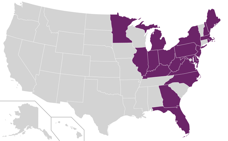
File:E-ZPass only states.svg
Appearance

Size of this PNG preview of this SVG file: 800 × 495 pixels. Other resolutions: 320 × 198 pixels | 640 × 396 pixels | 1,024 × 633 pixels | 1,280 × 791 pixels | 2,560 × 1,583 pixels | 959 × 593 pixels.
Original file (SVG file, nominally 959 × 593 pixels, file size: 33 KB)
File history
Click on a date/time to view the file as it appeared at that time.
| Date/Time | Thumbnail | Dimensions | User | Comment | |
|---|---|---|---|---|---|
| current | 21:07, 13 July 2024 |  | 959 × 593 (33 KB) | Epicgenius | add GA |
| 21:29, 16 June 2023 |  | 959 × 593 (33 KB) | Epicgenius | add MI (Bay City) | |
| 18:58, 3 August 2021 |  | 959 × 593 (33 KB) | Epicgenius | add MN | |
| 18:43, 30 June 2021 |  | 959 × 593 (36 KB) | Epicgenius | =={{int:filedesc}}== {{Information |description={{en|1=Map of states that use E-ZPass or a compatible electronic tolling system, according to [https://en.wikipedia.org/w/index.php?title=List_of_electronic_toll_collection_systems&oldid=857253080 the August 30, 2018, version] of List of electronic toll collection systems and the [https://www.e-zpassiag.com/about-us/members E-ZPass Interagency Group] page. This map only shows E-ZPa... |
File usage
The following page uses this file:
Global file usage
The following other wikis use this file:
- Usage on de.wikipedia.org
