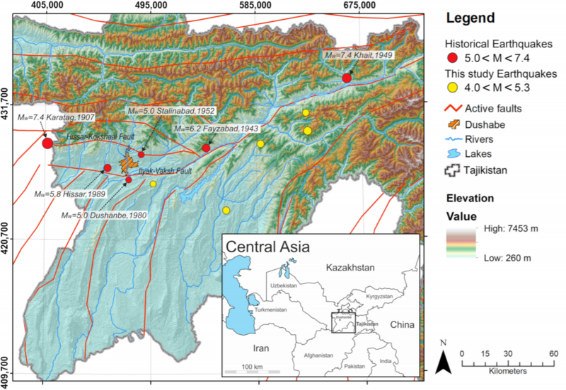
File:Dushanbe seismic map.png
Appearance

Size of this preview: 800 × 552 pixels. Other resolutions: 320 × 221 pixels | 640 × 442 pixels | 1,024 × 707 pixels | 1,128 × 779 pixels.
Original file (1,128 × 779 pixels, file size: 1.27 MB, MIME type: image/png)
File history
Click on a date/time to view the file as it appeared at that time.
| Date/Time | Thumbnail | Dimensions | User | Comment | |
|---|---|---|---|---|---|
| current | 23:17, 11 April 2021 |  | 1,128 × 779 (1.27 MB) | Zoozaz1 | Uploaded a work by Marco Pilz ; Dino Bindi ; Tobias Boxberger ; Farhod Hakimov ; Bolot Moldobekov ; Shohrukh Murodkulov ; Sagynbek Orunbaev ; Massimiliano Pittore ; Jacek Stankiewicz ; Shahid Ullah ; Firoz Verjee ; Marc Wieland ; Pulat Yasunov ; Stefano Parolai from First Steps toward a Reassessment of the Seismic Risk of the City of Dushanbe (Tajikistan) with UploadWizard |
File usage
The following page uses this file:
Global file usage
The following other wikis use this file:
- Usage on ca.wikipedia.org
