Jump to content

File:Cesko-kraje.svg

Page contents not supported in other languages.
This is a file from the Wikimedia Commons
From Wikipedia, the free encyclopedia

Original file (SVG file, nominally 3,433 × 1,973 pixels, file size: 195 KB)

Description
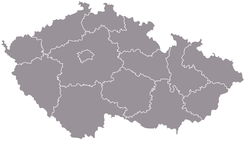
Čeština: Vektorová mapa Česka s dělením na kraje. V obrázku jsou drobné nepřesnosti dané jak hrubostí původních dat, tak vyhlazením. Jsou však minimální.
English: A vector map of the Czech regions. The map contains small incorrectnesses caused by roughness of the original data and its smoothing. They are, however, minimal.
Esperanto: Vektora mapo de Ĉeĥujo kun regiona dividigo. En la bildo estas malgrandaj malprecizaĵoj pro krudo de la origino kaj ties glatigo, ili tamen estas minimumaj.
Date
Source Tlusťa
Author
  • Originál • data origin: Tlusťa
  • Vyhlazení čar, úprava barev, export do svg • smoothing, colours, export to svg: Miraceti
  • Optimalizace • optimalization: Petr Adam Dohnálek
Permission
(Reusing this file)
  • Originál • data origin (Tlusťa):
Public domain This work has been released into the public domain by its author, Tlusťa. This applies worldwide.

In some countries this may not be legally possible; if so:
Tlusťa grants anyone the right to use this work for any purpose, without any conditions, unless such conditions are required by law.

  • Úpravy • adjusting ([1]):
    w:en:Creative Commons
attribution share alike
This file is licensed under the Creative Commons Attribution-Share Alike 3.0 Unported license.
You are free:
  • to share – to copy, distribute and transmit the work
  • to remix – to adapt the work
Under the following conditions:
  • attribution – You must give appropriate credit, provide a link to the license, and indicate if changes were made. You may do so in any reasonable manner, but not in any way that suggests the licensor endorses you or your use.
  • share alike – If you remix, transform, or build upon the material, you must distribute your contributions under the same or compatible license as the original.
Other versions Derivative works of this file:  CZ-cleneni-Slezsko-wl.svg

Captions

Add a one-line explanation of what this file represents

Items portrayed in this file

depicts

2 July 2006

image/svg+xml

23685d64c4989c0bd0e0c0d223dab705b9128be5

199,790 byte

1,973 pixel

3,433 pixel

File history

Click on a date/time to view the file as it appeared at that time.

Date/TimeThumbnailDimensionsUserComment
current17:53, 16 August 2009Thumbnail for version as of 17:53, 16 August 20093,433 × 1,973 (195 KB)Rianew colors
21:01, 12 February 2009Thumbnail for version as of 21:01, 12 February 20093,433 × 1,973 (186 KB)Kirk979correction of lines
08:54, 4 February 2009Thumbnail for version as of 08:54, 4 February 20093,433 × 1,973 (102 KB)Petrus AdamusVylepšení obvodu • perimeter repair
11:38, 3 February 2009Thumbnail for version as of 11:38, 3 February 20093,433 × 1,973 (74 KB)Petrus Adamusoptimalizace SVG • plibonigo de SVG • SVG optimalization
02:59, 2 July 2006Thumbnail for version as of 02:59, 2 July 20063,433 × 1,973 (170 KB)Happenstanceen: Czech regions cs: České kraje

The following page uses this file:

Global file usage