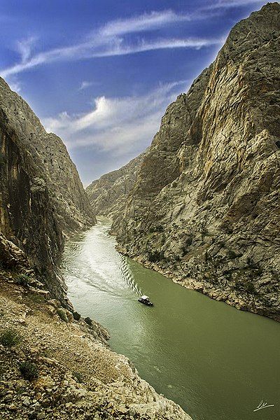
500px provided description: 11th Van region known to have been inhabited by the Armenians who moved to the first half of the century. Agri is the former name of the town, Armenian "eyes, spring" means. This form of the name in Turkish E?in
County, an important commercial hub in the early 1900s. Resources, all the surrounding cities of that period, it goes to trade e?in'e transfers. After the Republic, the county has been one of the places that intensive migration. At present, the tilt is registered in the population of 202 thousand people Kemaliyeliler vard?r.Tan?nm??, the former industry and trade minister, Ali Coskun, the former minister of energy and natural resources Ziya Aktas, poet-writer Ahmet Kutsi Tecer, the deputy prime minister Anwar Gokce Zeyyat Bayqara after September 12, Mustafa Oguz producer, poet, musician Beh?et Kemal Mustafa Specific Ages, player Harry Behavior, Ziyal ambassador to Rome, the political programs Kanalt?rk'te Tuncay Ozkan, Tahsin Sahin Yigit politician, journalist, Yusuf Ziya Ademhan, the former prime minister ?emsettin G?naltay (prime minister in 1949), and President of the Workers' Party of East PER?N?EK can be counted.
The public (Ba?ba?lar massacre) and the village of Ba?ba?lar needed, it depends on the county. The world's second largest after the dark canyon grand canyon, with the influx of foreign tourists who, however, is relatively unknown by tourists spectacular native town. Dark Canyon BASE jumping jumps since 2008 are part of the International Outdoor Sports. Living up to the 1940s, carpets, cloth weaving, shoemaking, copper handicrafts such that, but after the migration to the city, the population down to 2,500 in the summer due to the extreme sports, the town's population is 5000, is a region that attracts tourists during the summer months. Suitable for water sports such as rafting. Magnificient a town. Ancient trade routes is passed. Newspaper in the country has a far reaching Kemaliye countrymen. In general, the profession of butchery and meat industry, professions Kemaliye is preferred. The bridge is about the sequence of events in kemaliyedeki. One of the most depressing events kemaliye people in 2003 has been the death of ex-Governor Recep Yazicioglu. The bridge gives its name to a series of events, facilitating access to the bridge built by the governor. The bridge is called "Governor Recep Yaz?c?o?lu Bridge" respectively. Recep Yaz?c?o?lu for the people of this county was a man revered and loved.
Travels the famed traveler Evliya ?elebi, "filled with fruit, vineyards and orchards in a town," he Kemaliye mentions. Raftingten be made sport of mountain climbing nature of all kinds, the county average of Turkey, the literacy rate, the magnificent architecture of the structure. []


