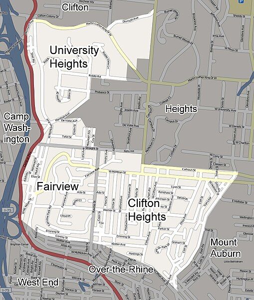
File:CUF-Cincinnati-Street-Map.jpg
Appearance

Size of this preview: 509 × 600 pixels. Other resolutions: 204 × 240 pixels | 407 × 480 pixels | 807 × 951 pixels.
Original file (807 × 951 pixels, file size: 285 KB, MIME type: image/jpeg)
File history
Click on a date/time to view the file as it appeared at that time.
| Date/Time | Thumbnail | Dimensions | User | Comment | |
|---|---|---|---|---|---|
| current | 03:46, 4 April 2009 |  | 807 × 951 (285 KB) | Wholtone | Updated borders between neighborhoods to those on http://www.cufna.org/ |
| 21:40, 17 August 2008 |  | 807 × 951 (285 KB) | Wholtone | not showing up as thumbnail.. | |
| 21:36, 17 August 2008 |  | 807 × 951 (285 KB) | Wholtone | {{Information |Description={{en|1=A street map of CUF, a neighborhood in Cincinnati, Ohio. CUF has three smaller districts inside of it: Clifton Heights, University Heights, and Fairview.}} |Source=http://www.openstreetmap.org/ |Author=[[User:Wholtone|Who |
File usage
The following page uses this file:
