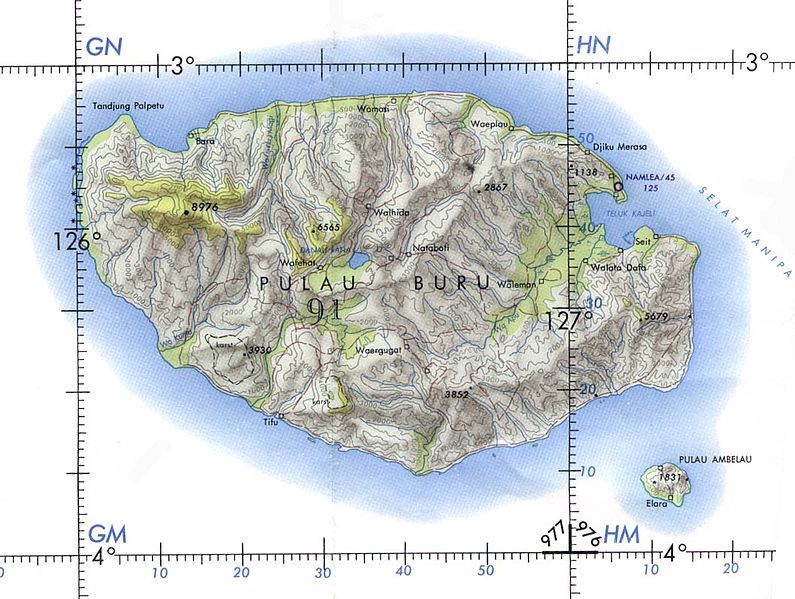
File:Buru tpc 1967.jpg
Appearance

Size of this preview: 795 × 599 pixels. Other resolutions: 318 × 240 pixels | 637 × 480 pixels | 1,019 × 768 pixels | 1,057 × 797 pixels.
Original file (1,057 × 797 pixels, file size: 149 KB, MIME type: image/jpeg)
File history
Click on a date/time to view the file as it appeared at that time.
| Date/Time | Thumbnail | Dimensions | User | Comment | |
|---|---|---|---|---|---|
| current | 11:23, 7 June 2006 |  | 1,057 × 797 (149 KB) | File Upload Bot (Magnus Manske) | {{Information| |Description= Buru Island (Operational Navigation Chart) original scale 1:1,000,000. Portion of Defense Mapping Agency ONC M-12 1967 (152K) Not for navigational use {{PD-PCL|http://www.lib.utexas.edu/maps/middle_east_and_asia/buru_tpc_19 |
File usage
The following 2 pages use this file:
Global file usage
The following other wikis use this file:
- Usage on ace.wikipedia.org
- Usage on ar.wikipedia.org
- Usage on bm.wikipedia.org
- Usage on ca.wikipedia.org
- Usage on cs.wikipedia.org
- Usage on eo.wikipedia.org
- Usage on et.wikipedia.org
- Usage on fr.wikipedia.org
- Usage on id.wikipedia.org
- Usage on it.wikipedia.org
- Usage on ja.wikipedia.org
- Usage on jv.wikipedia.org
- Usage on ka.wikipedia.org
- Usage on ru.wikipedia.org
- Usage on simple.wikipedia.org
- Usage on sv.wikipedia.org
- Usage on uk.wikipedia.org
- Usage on vi.wikipedia.org
- Usage on wuu.wikipedia.org
- Usage on zh.wikipedia.org

