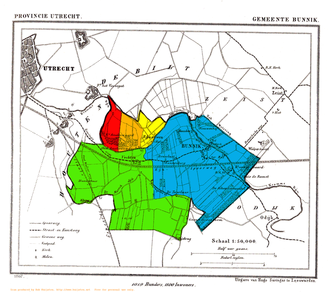
File:Bunnik Heerlijkheden.png
Appearance

Size of this preview: 680 × 600 pixels. Other resolutions: 272 × 240 pixels | 544 × 480 pixels | 871 × 768 pixels | 1,161 × 1,024 pixels | 1,567 × 1,382 pixels.
Original file (1,567 × 1,382 pixels, file size: 559 KB, MIME type: image/png)
File history
Click on a date/time to view the file as it appeared at that time.
| Date/Time | Thumbnail | Dimensions | User | Comment | |
|---|---|---|---|---|---|
| current | 19:03, 29 August 2009 |  | 1,567 × 1,382 (559 KB) | Eugene van der Pijll | {{Information |Description=Map of Bunnik, showing the fiefdoms (heerlijkheden) before 1795: Nieuw Amelisweerd (red), Oud-Amelisweerd (orange), Rhijnauwen (yellow), Vechten (green), Bunnik (blue). |Source= ''Gemeente Atlas van Nederland'', J. Kuyper 1865-1 |
File usage
The following page uses this file:
Global file usage
The following other wikis use this file:
- Usage on mk.wikipedia.org

