File:Brockhaus-Afrika-1887.jpg
Appearance

Size of this preview: 450 × 600 pixels. Other resolutions: 180 × 240 pixels | 360 × 480 pixels | 1,020 × 1,360 pixels.
Original file (1,020 × 1,360 pixels, file size: 1.65 MB, MIME type: image/jpeg)
File history
Click on a date/time to view the file as it appeared at that time.
| Date/Time | Thumbnail | Dimensions | User | Comment | |
|---|---|---|---|---|---|
| current | 10:24, 23 July 2013 |  | 1,020 × 1,360 (1.65 MB) | Roxanna | auto adjust colours |
| 19:56, 29 January 2010 |  | 1,020 × 1,360 (1.48 MB) | Roxanna | bessere Auflösung des Ostafrika-Ausschnitts | |
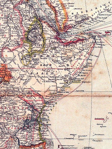
| 13:52, 29 January 2010 |  | 600 × 800 (497 KB) | Roxanna | Ausschnitt Ostafrika vom Rovuma bis zum Horn von Afrika, Deutsch-Ostafrika ist blau, britische Gebiete rot, das noch unabhängige Sultanat Sansibar grün, Somalia ist beschriftet als "Besitz der Deutsch-Ostafrikanischen Gesellschaft" | |
| 13:48, 29 January 2010 |  | 2,336 × 3,307 (3.56 MB) | Roxanna | {{Information |Description={{de|1=Übersichtskarte von Afrika, Stand der kolonialen Aufteilung 1887, Besitzungen und Schutzgebiete - nach der deutsch-britischen Interessensabgrenzung von 1886, vor der Aufteilung des sansibarischen Festlandbesitzes 1888}} |
File usage
The following page uses this file:
Global file usage
The following other wikis use this file:
- Usage on de.wikipedia.org
- Usage on fr.wikipedia.org
- Usage on pt.wikipedia.org
- Usage on ru.wikipedia.org
- Usage on www.wikidata.org
