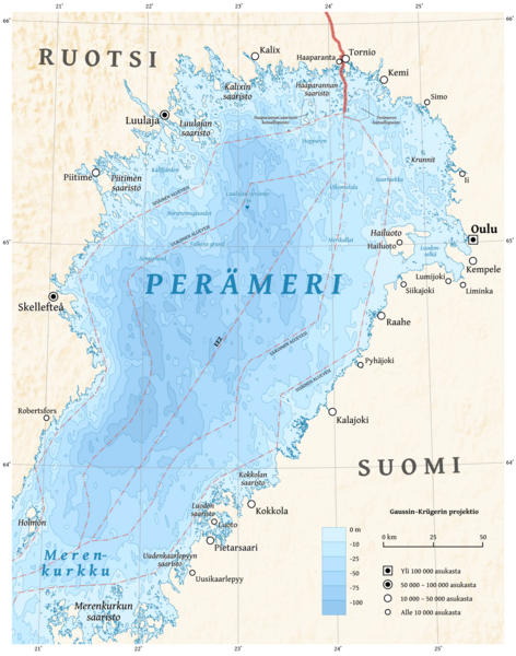
File:Bothnian Bay map-fi.png
Appearance

Size of this preview: 472 × 600 pixels. Other resolutions: 189 × 240 pixels | 378 × 480 pixels | 604 × 768 pixels | 806 × 1,024 pixels | 1,889 × 2,400 pixels.
Original file (1,889 × 2,400 pixels, file size: 2.94 MB, MIME type: image/png)
File history
Click on a date/time to view the file as it appeared at that time.
| Date/Time | Thumbnail | Dimensions | User | Comment | |
|---|---|---|---|---|---|
| current | 09:04, 30 October 2011 |  | 1,889 × 2,400 (2.94 MB) | Halava | Bigger vesion with better contrast |
| 17:04, 29 October 2011 |  | 1,574 × 2,000 (2.2 MB) | Halava | Slightly sharper version | |
| 16:04, 29 October 2011 |  | 1,574 × 2,000 (2.22 MB) | Halava | {{Information |Description ={{fi|1=Perämeren kartta.}} {{en|1=Map of the Bothnian Bay in Finnish.}} |Source ={{own}} using GRASS GIS, Inkscape and GIMP. Data sources: * Bathymetry and shade relief are from SRTM30 Plus. * Coastlines are simpli |
File usage
The following 3 pages use this file:
Global file usage
The following other wikis use this file:
- Usage on ca.wikipedia.org
- Usage on de.wikipedia.org
- Usage on fi.wikipedia.org
- Usage on fr.wikipedia.org
- Usage on gl.wikipedia.org
