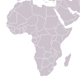
File:BlankMap-Africa.png
Appearance
BlankMap-Africa.png (341 × 341 pixels, file size: 8 KB, MIME type: image/png)
File history
Click on a date/time to view the file as it appeared at that time.
| Date/Time | Thumbnail | Dimensions | User | Comment | |
|---|---|---|---|---|---|
| current | 12:01, 8 March 2018 |  | 341 × 341 (8 KB) | Maphobbyist | South Sudan border |
| 17:56, 29 March 2016 |  | 380 × 360 (8 KB) | Fry1989 | Reverted to version as of 22:40, 26 December 2014 (UTC) | |
| 20:29, 27 March 2016 |  | 341 × 341 (3 KB) | Rockthe | Reverted to version as of 16:47, 3 April 2005 (UTC) | |
| 22:40, 26 December 2014 |  | 380 × 360 (8 KB) | Middayexpress | fix legal border | |
| 06:28, 7 April 2012 |  | 380 × 360 (11 KB) | Spesh531 | Libyan civil war long over, adjusted azawad border +minor fixes | |
| 02:18, 7 April 2012 |  | 380 × 360 (12 KB) | Phoenix B 1of3 | Azawad | |
| 22:23, 11 July 2011 |  | 380 × 360 (8 KB) | Spesh531 | back to the newer version,YOU COULD HAVE JUST EDITED THE OTHER VERSION. | |
| 19:11, 9 July 2011 |  | 341 × 341 (9 KB) | Maphobbyist | South Sudan has become independent on July 9, 2011. Sudan and South Sudan are shown with the new international border between them. | |
| 01:57, 2 March 2011 |  | 351 × 341 (11 KB) | Spesh531 | With new standards and South Sudan, and unrecognized countries | |
| 17:03, 20 February 2007 |  | 341 × 341 (3 KB) | ፈቃደ | Reverted to earlier revision |
File usage
The following 6 pages use this file:
Global file usage
The following other wikis use this file:
- Usage on af.wikipedia.org
- Usage on am.wikipedia.org
- Usage on ar.wikipedia.org
- Usage on da.wikipedia.org
- Usage on es.wikipedia.org
- Usuario Discusión:Dark512
- Usuario:Dark512
- Usuario:Suomi 1973
- Usuario:Userbox/Wikiproyectos
- Usuario:Millars
- Wikiproyecto:África
- Wikiproyecto:África/Userbox
- Usuario:Userbox/Localización/África
- Usuario:Tlalcomulco
- Usuario:Jomiabe
- Usuario:Julioms64
- Usuario:Santi92/Userboxes
- Usuario:Lanke Llion
- Usuario:MucosoPucoso
- Usuario:74MMOTPH
- Usuario:Xatanga
- Usuario:Jafol
- Usuaria:Meltryth
- Usuaria:Userbox mujer/Wikiproyectos
- Usuaria:Userbox mujer/Localización/África
- Usuario:Assacen
- Usuario:Planeta de Cor-Azul
- Usuario:Planeta de Cor-Azul/PU
- Usuario:ARGFutbolero
- Usage on fr.wikipedia.org
- Usage on ht.wikipedia.org
- Usage on hu.wikipedia.org
- Usage on hy.wikipedia.org
- Usage on id.wikipedia.org
- Usage on incubator.wikimedia.org
- Usage on ko.wikipedia.org
- Usage on lv.wikipedia.org
- Usage on new.wikipedia.org
- Usage on nl.wikipedia.org
- Usage on no.wikipedia.org
View more global usage of this file.


