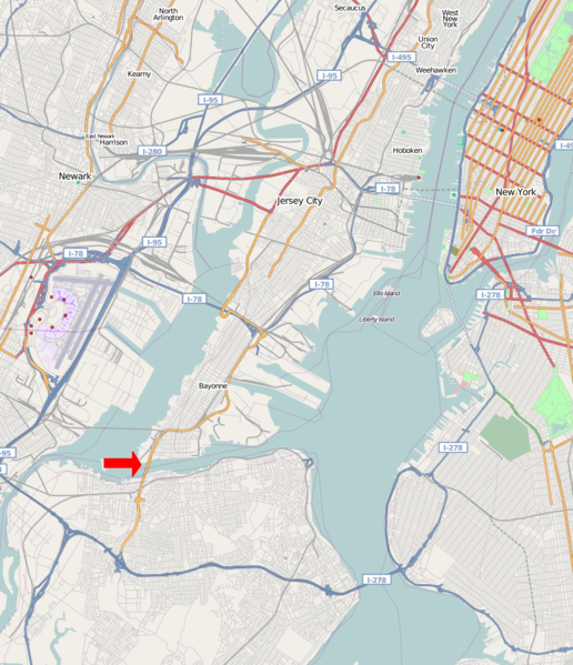
File:Bayon Bridge Map.png
Appearance

Size of this preview: 516 × 599 pixels. Other resolutions: 207 × 240 pixels | 413 × 480 pixels | 872 × 1,013 pixels.
Original file (872 × 1,013 pixels, file size: 923 KB, MIME type: image/png)
File history
Click on a date/time to view the file as it appeared at that time.
| Date/Time | Thumbnail | Dimensions | User | Comment | |
|---|---|---|---|---|---|
| current | 14:50, 14 August 2008 |  | 872 × 1,013 (923 KB) | Natl1 | {{OpenStreetMap |source=http://www.openstreetmap.org/?lat=40.68545&lon=-74.08330000000001&zoom=11&layers=B00FTFT |location=the Bayonne Bridge and Surrounding Area }} <!--{{ImageUpload|basic}}--> |
File usage
The following page uses this file:
Global file usage
The following other wikis use this file:
- Usage on de.wikipedia.org
- Usage on es.wikipedia.org
- Usage on fi.wikipedia.org
- Usage on fr.wikipedia.org


