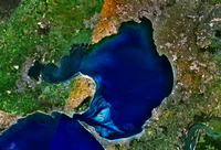
File:Bass Strait Port Phillip Bay detail 19th century.svg
Appearance

Size of this PNG preview of this SVG file: 770 × 600 pixels. Other resolutions: 308 × 240 pixels | 617 × 480 pixels | 986 × 768 pixels | 1,280 × 997 pixels | 2,560 × 1,993 pixels | 1,423 × 1,108 pixels.
Original file (SVG file, nominally 1,423 × 1,108 pixels, file size: 922 KB)
File history
Click on a date/time to view the file as it appeared at that time.
| Date/Time | Thumbnail | Dimensions | User | Comment | |
|---|---|---|---|---|---|
| current | 14:29, 25 September 2023 |  | 1,423 × 1,108 (922 KB) | Goran tek-en | {{Information |description ={{en|Bass Strait places associated with the residences of the family of Margery Munro, around 1890.}} {{Institution |wikidata=Q24204956}} {{Institution |wikidata=Q1324526}} {{Institution |wikidata=Q171846}} |date =2023-09-25 |source ={{Own based|Admiralty Chart No 2759b Australia southern portion, Published 1885.jpg|Map of part of New Holland showing the territory of Geelong and Dutigalla.png|Furneaux Group Map.svg|BlankMap-World gray.svg... |
File usage
The following page uses this file:


