File:Angola-Namibia-Border Locator.png
Appearance
Angola-Namibia-Border_Locator.png (550 × 304 pixels, file size: 68 KB, MIME type: image/png)
File history
Click on a date/time to view the file as it appeared at that time.
| Date/Time | Thumbnail | Dimensions | User | Comment | |
|---|---|---|---|---|---|
| current | 22:24, 20 March 2009 |  | 550 × 304 (68 KB) | Mahahahaneapneap | Compressed |
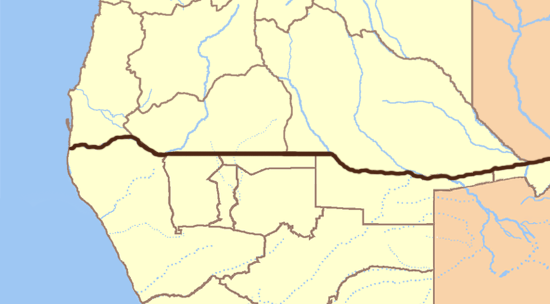
| 11:24, 7 February 2009 |  | 550 × 304 (75 KB) | LouriePieterse | {{Information |Description={{en|1=Blank map of Angola and Namibia, divided into provinces. You can see the border as a darkened line on the image.}} |Source=Own work by uploader. |Author=Slapsnot |Date=07 February 2009 |Permission= |othe |
File usage
The following page uses this file:
Global file usage
The following other wikis use this file:
- Usage on ar.wikipedia.org
- Usage on bs.wikipedia.org
- Usage on ca.wikipedia.org
- Usage on ceb.wikipedia.org
- Usage on ckb.wikipedia.org
- Usage on da.wikipedia.org
- Usage on de.wikipedia.org
- Usage on fa.wikipedia.org
- Usage on ha.wikipedia.org
- Usage on it.wikipedia.org
- Usage on kn.wikipedia.org
- Usage on ms.wikipedia.org
- Usage on ru.wikipedia.org
- Usage on tg.wikipedia.org
- Usage on tr.wikipedia.org
- Usage on vi.wikipedia.org
- Usage on war.wikipedia.org


